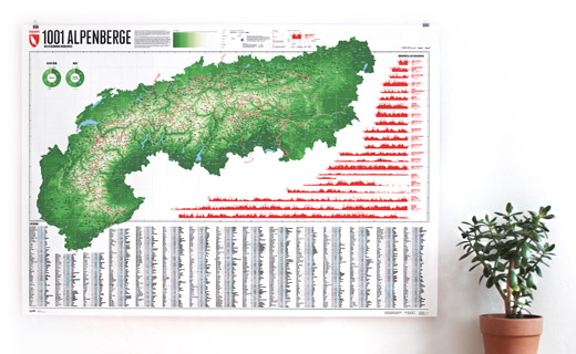
The Schesaplana is rising close to the southern tripoint between Switzerland, Austria, and Liechtenstein. Situated in the center of the Alps and being the high point of the Rätikon the summit offers a view over hundreds of Alpine mountains up to the Pennine Alps, Ötztal Alps, the Zugspitze massif, and beyond. On the way to the mountain top different mountain huts can be passed, such as the Mannheimer Hütte in the north behind the Brandner Glacier, the Douglashütte at the Lünersee in the east, or the Schesaplanahütte in the south.
Language:
Size:
More information about the different materials.
Elevation: 2964 m
Country and region: Austria, Vorarlberg / Switzerland, Grisons
Mountain range: Rätikon
Prominence: 826 m
Orometric dominance: 28
Coordinates: 47.053889, 9.707222


 Druck")