 Atlas Retro
 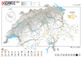 Map Grey
 Map of Switzerland – and Liechtenstein –
in two unique Marmota Maps-styles.
Release date: 01-12-2021
Size: 100 x 70 cm
Print: Digital print 200 g matt
Language: German
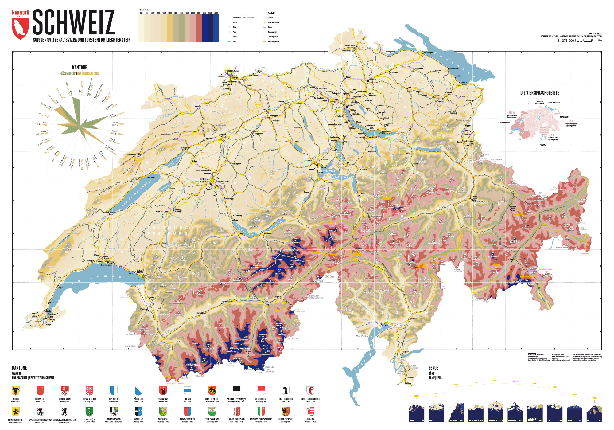
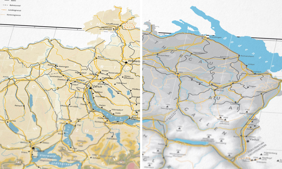
Basic structure of our map
The backbone of our map consists of contour lines at intervals of 200 meters for lower heights and 500 meters for heights from 2,000 meters above sea-level. Thus, the map looks vivid and nicely illustrates the topography of the landscape.
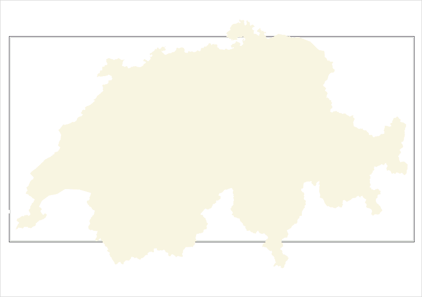
In addition the Switerland maps show the most important cities, streets, rivers and waters, the most important mountains, as well as the borders of the 26 Swiss cantons and the small neighbouring country, the Principality of Liechtenstein.
Unique Styles
Our map of Switzerland is available in two different designs.
The Atlas Retro-style is characterized by subtle, muted colors, based on the classic altitude profile maps from the atlas.
The Map Grey-style consists of different shades of grey for the altitude levels. This map style is especially suitable if you want to put your own markings onto the map.
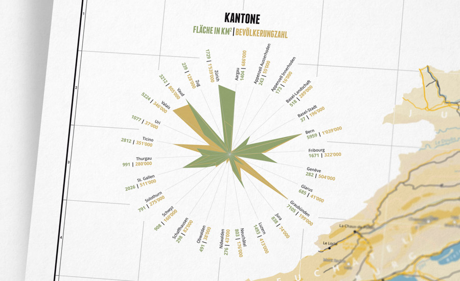
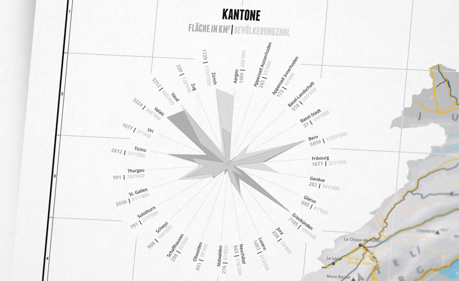
26 Cantons of Switzerland
Our infographic features the 26 Swiss cantons and contrasts their population and area.
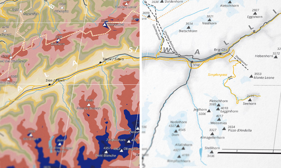
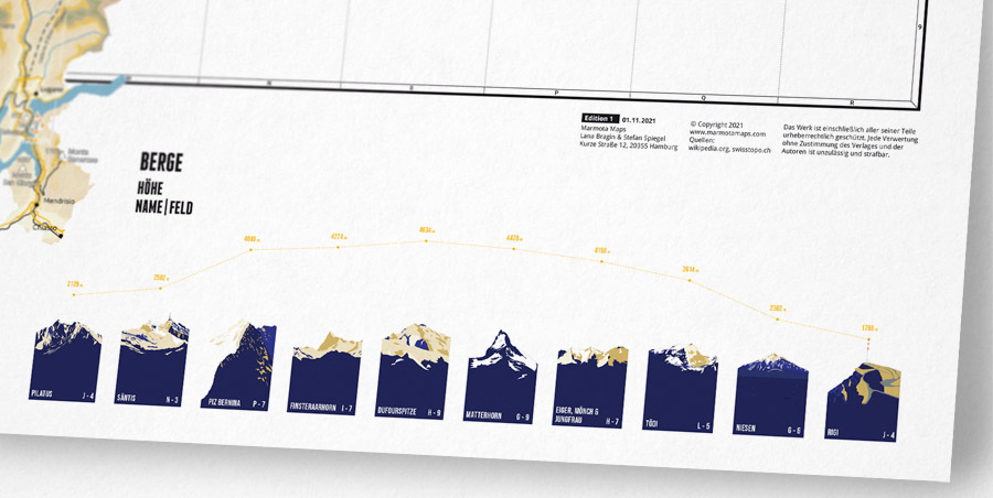
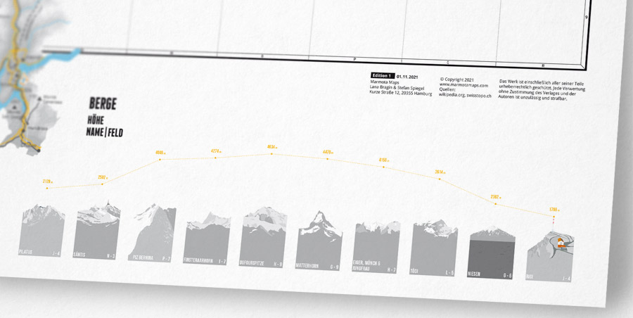
Mountains of Switzerland
The vast number of great Swiss mountains makes it almost impossible to select. Yet, the map features ten special summits of Switzerland:
Pilatus, Säntis, Piz Bernina, Finsteraarhorn, Dufourspitze, Matterhorn, Eiger, Mönch & Jungfrau, Tödi, Niesen and Rigi.
Over 200 other mountains are marked on the map.
You can find more mountain illustrations of Swiss summits here: Marmota Maps Mountain Prints.
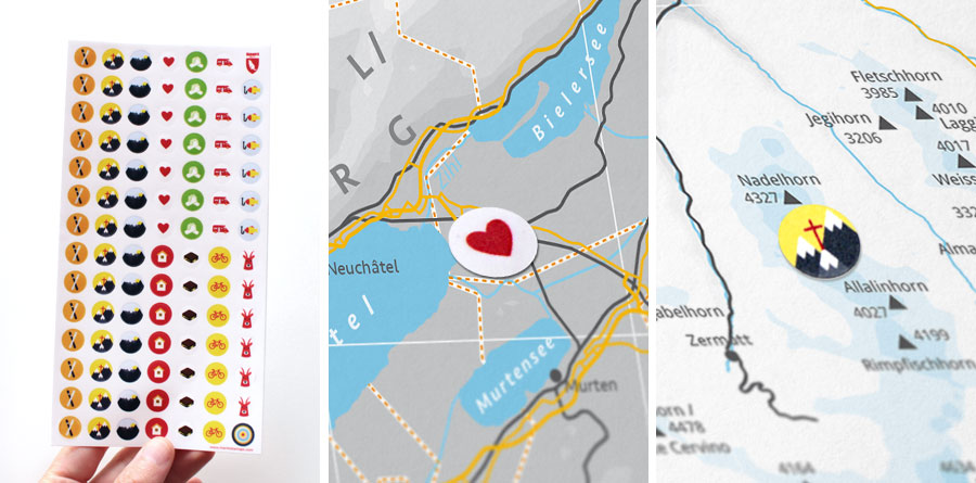
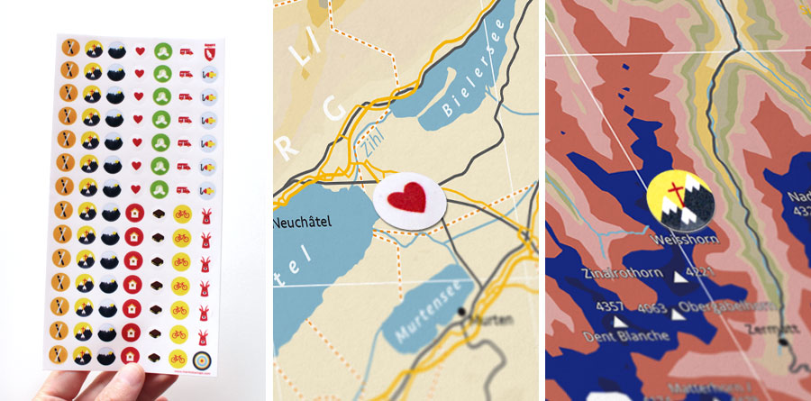
Marmota Stickers
for the Switzerland Map
Our matching Marmota sticker set let you mark your favourite places and special adventures.
Basic structure of our map
The backbone of our map consists of contour lines at intervals of 200 meters for lower heights and 500 meters for heights from 2,000 meters above sea-level. Thus, the map looks vivid and nicely illustrates the topography of the landscape.
In addition the Switerland maps show the most important cities, streets, rivers and waters, the most important mountains, as well as the borders of the 26 Swiss cantons and the small neighbouring country, the Principality of Liechtenstein.
Unique Styles
Our map of Switzerland is available in two different designs.
The Atlas Retro-style is characterized by subtle, muted colors, based on the classic altitude profile maps from the atlas.
The Map Grey-style consists of different shades of grey for the altitude levels. This map style is especially suitable if you want to put your own markings onto the map.
26 Cantons of Switzerland
Our infographic features the 26 Swiss cantons and contrasts their population and area.
Mountains of Switzerland
The vast number of great Swiss mountains makes it almost impossible to select. Yet, the map features ten special summits of Switzerland:
Pilatus, Säntis, Piz Bernina, Finsteraarhorn, Dufourspitze, Matterhorn, Eiger, Mönch & Jungfrau, Tödi, Niesen and Rigi.
Over 200 other mountains are marked on the map.
You can find more mountain illustrations of Swiss summits here: Marmota Maps Mountain Prints.
Marmota Stickers
for the Switzerland Map
Our matching Marmota sticker set let you mark your favourite places and special adventures.