Der Pilatus ist ein Gebirgsstock der Emmentaler Alpen, im Westen des Vierwaldstätter Sees. Das Pilatus-Massiv besteht aus einer Reihe von Gipfeln, von denen das Tomlishorn der höchste ist. Neben einer Seilbahn führt auch die Pilatusbahn zum Gipfel, die mit einer maximalen Steigung von 48 % als steilste Zahnradbahn der Welt gilt.
The Piz Ault lies south of the Oberalpstock. Both mountains rise above the Vorderrhein valley and the town of Disentis. The ski lifts of the ski resort Disentis 3000 go up as high as 2800 meters, just below the summit of the Piz Ault. A popular stop in the summer and the winter is the hut of the Swiss Alpine Club Camona da Cavardiras west of the mountain, on the other side of the Brunni Glacier.
Der Name Badile bedeutet im Italienischen „Schaufel“, weil die berüchtigte Nordostwand des Berges tatsächlich einem Schaufelblatt ähnelt. Zusammen mit seinen Nachbargipfeln gehört der Piz Badile zu den berühmtesten Kletterbergen der Alpen. Seine Nordwand gilt als äußerst anspruchsvoll.
Piz Bernina is the only four-thousander in the Eastern Alps and the most isolated mountain in Switzerland. The first ascent was made by Johann Coaz in 1850. His journal entries show his love for the Alps: “Serious thoughts took hold of us. Greedy eyes surveyed the land up to the distant horizon, and thousands and thousands of mountain peaks surrounded us, rising as rocks from the glittering sea of ice. We stared amazed and awe-struck across this magnificent mountain world.”
Zwischen Splügenpass und Chur erhebt sich der Piz Beverin in den östlichen Adula Alpen. Der relativ freistehende Gipfel bietet eine hervorragende Aussicht. Ausser Wanderwegen führen unterschiedlich schwierige Kletterrouten auf den Piz Beverin. Zudem ist der Berg beliebtes Ziel für Skitouren. Rund um den Berg befindet sich der Naturpark Beverin. Neben dem Graubündner Wappentier, dem Steinbock, lebt hier auch ein Wolfsrudel.
Piz Buin is one of the most distinctive mountains of the Montafon, an Ill-valley in Vorarlberg. Being part of the Silvretta range the Austrian-Swiss border runs along the mountain summit. The Ill's headwaters are two glaciers on the Austrian side of the mountain. The ascent to the mountain becomes more difficult with the shrinking glaciers. During winter time however one can ski on beautiful trails all the way from the summit into the valley.
Der höchste Berg der Bündner und der Albula-Alpen liegt zentral in Graubünden. Diese zentrale Lage macht den Piz Kesch zu einem beliebten Tourenziel. Als höchste Erhebung zwischen Silvretta und Adula Alpen bietet er vom Gipfel eine der schönsten Aussichten der Region. Bei guter Sicht reicht der Blick bis zu den Ötztaler Alpen, Ortler und Adamello, der Berninagruppe und den Walliser Alpen.
Piz Linard ist der höchste Gipfel der Silvrettagruppe und wird oft als einer der formschönsten Berge der Alpen genannt. Er bildet eine symmetrische Gipfelpyramide und wirkt aus allen Blickrichtungen markant. Der Piz Linard überragt die Umgebung um bis zu 2 000 Meter und ist dadurch weithin sichtbar. Von Zernez im Unterengadin bildet er einen beeindruckenden Talschluss und wird oft als Wahrzeichen des Unterengadins bezeichnet.
Piz Medel is a peak in the Adula Alps, a part of the Lepontine Alps on the border between the Swiss cantons of Graubünden and Ticino. West of the summit is the Greina, an important Alpine pass between the two cantons, which was already used in ancient times. A number of huts are situated around the summit as starting points for tours around the mountain, among them the Medel Hut. As many other mountains in the area the Piz Medel is a worthwile destination for ski mountaineering.
Auf der Südseite der Graubündner Gemeinde Disentis/Mustér erhebt sich der Piz Muraun. Dem Gipfel gegenüber liegen im Norden Piz Ault und Oberalpstock. Im Süden ragt der gut 300 Meter höhere Piz Medel empor. Auch wenn der Aufstieg zum Gipfel des Piz Muraun ohne echte Kletterpassagen zu bewerkstelligen ist, handelt es sich doch um eine anspruchsvolle Wanderroute. Für weniger sportlich Geübte empfiehlt sich eine Fahrt mit dem berühmten Glacier Express nach Disentis, die eine spektakuläre Aussicht auf den Berg bietet.
Piz Palü is a well renowned mountain for cineasts. The movie “The White Hell of Pitz Palu” from 1929 portrays a mountaineer looking for the dead body of his wife who was hit by an avalanche. The name is probably derived from the Latin word “palus”, meaning “swamp”. The mountain than was named after the pasture Alpe Palü which lies four kilometers east of the summit.
Der Piz Val Gronda liegt in der Samnaungruppe, direkt an der Grenze zwischen Österreich und der Schweiz. Auf Schweizer Gebiet im Fimbatal, südwestlich des Gipfels, befindet sich die Heidelberger Hütte, Ausgangspunkt für Skitouren und der wichtigste Stützpunkt zur Erwanderung des Bergs. Von hier ist der Gipfel in etwa zwei Stunden problemlos erreichbar.
Piz Vallatscha is a Three-thousander in the Sesvenna Alps, a mountain group in the border triangle between Tyrol in Austria, South Tyrol in Italy, and the Swiss canton Graubünden. North west of the summit is the higher Piz Tavrü. In the south east the lifts of the ski area Minschuns reach a height of 2700 meters. South of the Piz Vallatscha is the Fuorn Pass, an important and old part of the connection betwenn the valleys of Inn and Adige (Etsch).
The Pizol is a 2844 m high mountain in the Glarus Alps in the Swiss canton of St. Gallen. The Pizol hiking and skiing area on the north side of the mountain was accessible via Switzerland's oldest gondola lift, which has been replaced in 2007 with a modern lift. The Pizol is also a popular starting point for ski mountaineers.
Pizzo Coca is the highest mountain of the Bergamo Alps, a cliffy mountain range falling steeply down towards the north. It is one of the southernmost three-thousanders of the Italian Alps. From the summit you have a stunning view over northern Italy. To the north one can see Piz Bernina, the easternmost four-thousander of the Alps.
Der Pizzo di Gino ist der höchste Gipfel der Luganer Voralpen in der Lombardei und gilt als Grenzberg zwischen den Vor- und Hochalpen. Der Berggipfel gleicht einer ebenmäßigen, dreiseitigen Pyramide aus Gestein. An den Berghängen entspringt der Wildbach Cuccio. Im Nordwesten des Pizzo di Gino liegt der Bergtal Valle Albano.
Presanella is the highest mountain of the Adamello-Presanella range in the Italian Alps. The first ascent was made by the British Douglas William Freshfield on 25th August 1864. Since the identity of his companions remains under dispute Freshfield is often named as the sole first climber of the mountain.
The Rax massif is located north of the Semmering Pass and is part of the Rax-Schneeberg group. The highest point of the mountain plateau is the Heukuppe. In 1894 Fritz Benesch developed the first grading system for alpine climbs at the Rax. In addition, after a disastrous avalanche the world's first mountain rescue service was founded here in 1896.
Die Reisalpe ist der höchste Berg der Gutensteiner Alpen. Felsen gibt es hier lediglich an der Südwest und Nordseite, ansonsten ist der Berg fast vollständig von Wald, Wiesen und Almen mit Viehhaltung bedeckt. Die brüchige Hirschenmauer im Südwesten fällt vom Almgelände ab und bildet eine grosse Schutthalde. Hier besteht Absturz-, und Steinschlaggefahr. Vermutlich ist die Hirschmauer Namensgeber des Berges: Das brüchige Gestein „rieselt“ von der Alpe ins Tal.
Der Reschensee ist vor allem für seinen aus dem Wasser ragenden Kirchturm bekannt – ein Wahrzeichen des versunkenen Dorfes Alt-Graun. Der künstlich angelegte See liegt auf etwa 1500 Metern Höhe nahe der Grenze zu Österreich und ist heute ein beliebtes Ziel für Wassersport, Radfahren und Wintertourismus.
Das Rheinwaldhorn ist der höchste Berg der Adula Alpen. Auf italienisch heißt der Berg Adula. Der Name tauchte bereits auf historischen Karten des Römischen Reiches auf. Weitere Namen für den Berg waren Rheinwaldspitze, Schneehorn, Adulahorn und Moschelhorn. Das Rheinwaldhorn wird von mehreren Gletschern dominiert, die das flache Gipfelplateau prägen. An seinen Flanken entspringt der Hinterrhein, einer der beiden Zuflüsse des Rheins.
Das Riedberger Horn ist ein markanter Grasberg im Allgäu und der höchste Berg der Hörnergruppe im Nordwesten von Oberstdorf. Der Gipfel ist leicht zu erreichen und bietet einen wunderschönen Blick auf die Allgäuer Hochalpen mit dem Hochvogel und dem Großen Krottenkopf. Das Gebiet am Riedberger Horn gilt als ideales Wandergebiet für Familien und Menschen ohne Vorerfahrung. Nur der Weg über den Nordostgrat ist etwas herausfordernder.
The Rigi is a mountain massif with the highest peak Rigi Kulm. It is located between Lake Lucerne, Lake Zug and Lake Lauerz and offers a spectacular view over large parts of the Swiss Alps. This is one of the reasons why the first mountain railway in Europe, the Vitznau-Rigi-Bahn, was build here in 1871. Rigi has attracted famous guests for centuries: Twain and Goethe visited the massif and Tolstoi even described the view as “the most beautiful in the world”.
Zwischen Monte Rosa im Süden und der Mischabelgruppe im Norden erhebt sich das Rimpfischhorn als höchster Punkt der Allalingruppe. Sein Felsgrat steigt langsam von Norden bis zum höchsten Gipfel im Süden an. Entsprechend wirkt der Berg von Süden aus gesehen als steil aufragendes, steinernes Dreieck, während er von Westen und Osten seine Felszacken präsentiert. Das Rimpfischhorn eignet sich sowohl als Ziel für Hochtouren im Sommer wie auch für Skitouren im Winter.
Im Westen von Chur erhebt sich der Ringelspitz über das Vorderrheintal. Der Berg, der auf rätoromanisch als Piz Barghis bekannt ist, ist der höchste Gipfel des Kantons St. Gallen und liegt auf der Grenze zu Graubünden. Für Touren zum Gipfel bietet sich als Ausgangspunkt die Ringelspitzhütte des Schweizer Alpen-Clubs im Südosten des Bergs an. Für den Aufstieg besonders geeignet sind die Winter- und Frühjahrsmonate.
Risserkogel, the second highest summit of the Tegernsee Mountains, is situated south of the slightly lower Plankenstein whose distinctive peaks make it a popular destination for climbers. The ascent to the summit of Risserkogel can be achieved with a two to four hour hike, depending on the chosen path. This makes the mountain a popular destination, notably for the inhabitants of Munich and the surrounding area.
The rocky spires of the Rosengarten group rise to the east of Bolzano in the Dolomites. Its highest summit is the Kesselkogel. At sunset, the rock of this popular viewpoint glows in magnificent shades of red – a phenomenon known as alpenglow, or enrosadira in Ladin. Legend surrounds the mountain: the dwarf king Laurin is said to have cursed the Rosengarten after losing a battle for the king's daughter. The "Gartl" was to be visible neither by night nor by day, which is why today it appears only at dusk, during the alpenglow.
As one of the western summits of the Daumen Group the Rubihorn and its summit cross tower west of the Nebelhorn and north of the Schattenberg. The mountain is named after the town Rubi, which is situated north of Oberstdorf. The mountain top offers a stunning view over the Iller Valley and the surrounding summits. One of the most scenic routes to the summit leads from the east along the picturesque Gaisalpsee.
Situated in northeastern Switzerland Säntis is the highest mountain of the Alpstein massif with a height of 2501 m. It is the thirteenth most prominent mountain in the entire Alps. On the summit the borders of three Swiss cantons meet. On a clear day you can see six of the eight Alpine countries from there.
Etwa 1000 Meter erhebt sich der Sassongher als mächtiger Felsturm über das südliche Gadertal und den Ort Corvara. Der markante Berg ist Teil des Naturpark Puez-Geisler, in dessen Südosten er sich befindet. Den Gipfel des Sassongher zu erreichen ist erfahrenen Kletterern vorbehalten. Für die Mühen wird man mit einer beeindruckenden Aussicht von oben belohnt. Der Berg ist bekannt für die tollen Panoramen anderer Dolomitengipfel von Fanesgruppe über Sellastock bis zur Marmolata.
Located in the Ammergau Alps, on the German-Austrian border, Säuling is the landmark mountain of the town of Füssen, which is situated in the north west. The summit offers a spectacular view of the nearby lakes, and also of the two castles of Hohenschwangau and world-famous Neuschwanstein. Even though the Säuling's summit appears rather pyramid-shaped, its name is presumably derived from the German word “Säule” (pillar), since the mountain rises up steeply above the surrounding area.
The Schesaplana is rising close to the southern tripoint between Switzerland, Austria, and Liechtenstein. Situated in the center of the Alps and being the high point of the Rätikon the summit offers a view over hundreds of Alpine mountains up to the Pennine Alps, Ötztal Alps, the Zugspitze massif, and beyond. On the way to the mountain top different mountain huts can be passed, such as the Mannheimer Hütte in the north behind the Brandner Glacier, the Douglashütte at the Lünersee in the east, or the Schesaplanahütte in the south.
At 2563 m, the Schlern is one of the landmarks of South Tyrol and the Dolomites thanks to its distinctive shape. The mountain is celebrated, among other places, in the “Bozner Bergsteigerlied”, one of the unofficial anthems of South Tyrol. According to legend, the Schlern witches get up to mischief around the mountain, causing storms and other misfortune above all.
At 2076 m, the Schneeberg is the highest mountain in Lower Austria and the easternmost two-thousand-metre peak in the Alps. After the Großglockner it has the greatest dominance of all Austrian mountains. In good visibility you can see the capital, Vienna, from the summit. For its residents the mountain is a popular destination close to home.
Das Schreckhorn ist der nördlichste Viertausender Europas. Steil ragt der mächtige Felszacken südlich von Grindelwald empor. Zusammen mit dem nur unwesentlich niedrigeren Lauteraarhorn bildet das Schreckhorn einen imposanten Doppelgipfel. Häufig wird das Schreckhorn als der am schwierigsten zu besteigende Viertausender der Alpen bezeichnet. Der Berg gilt als Geheimtipp für erfahrene Bergsteiger, da es wegen seiner abseitigen Lage eher menschenleer ist.
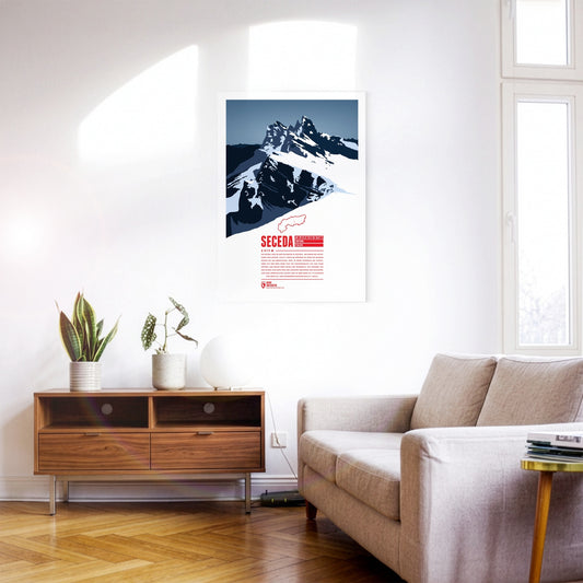
The Seceda lies in the Dolomites in South Tyrol, on the edge of the Puez-Odle Nature Park. From Ortisei in Val Gardena, the Seceda cable car runs up to the top station, about 70 metres below the summit. At the top the mountain offers a panoramic view over almost all of South Tyrol and beyond across Italy and Austria. The ski resort on the Seceda-Alm has one of the longest descents in the Dolomites: from just below the summit it runs more than 10 kilometres and over 1000 metres of vertical drop down to Ortisei.