What makes the right ski? This print sums up the decisive characteristics clearly: camber, contour, ski length, flex, radius and snow conditions. A clear infographic that makes complex ski knowledge easy to grasp – ideal for anyone who really wants to understand their equipment.
What defines a mountain? A mountain rises above its surroundings. At the same time, not every small elevation is considered a mountain. So what criteria decides what is and what isn’t a mountain? With the help of geography, a mountain can be described objectively. The most important feature of a mountain is its height above sea level. Mountaineers often strive to conquer certain thousand-metre markers. The topographic prominence measures the independence of a summit. Depending on its location, a mountain in the Alpine foothills that is only a few hundred metres high can seem more impressive than a sub peak with a height of over 4 000 metres in the Mont Blanc or Monte Rosa massif.
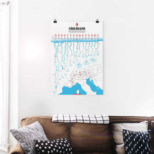
Some of Central Europe’s most important rivers have their source in the Alps. In this graphic we present the 15 longest rivers in the Alps. The Rhine is the longest Alpine river followed by the Sava, one of the many Danube tributaries in the Alps and the longest river in Slovenia. The third longest Alpine river is the Rhone, which while not the longest in France does have the largest volume of water of all French rivers.
The Marmota Maps year calendar for 2027 is all about the names of the months.
Roman gods and emperors, old farmers' names, a calendar reformed twice – and a
year that used to begin in March.
At 1948 metres, the Klausen Pass links the Schächental in Uri with the Linthal in Glarus. Our print shows it from the eastern side: the hairpins of the pass road high above the Urnerboden, which at eight kilometres long is the largest alpine pasture in Switzerland, grazed by around 1200 cattle each summer. Below runs the Fätschbach, which rises beneath the Clariden, bursts from the rock face as a spring waterfall and further down tumbles over the ledges of the Berglistüber into the Linthal. The pass road was built between 1893 and 1899, and from 1922 to 1934 the legendary Klausen race was held here – in winter the crossing is closed.
At 1750 metres the Monte Zoncolan is no giant – and yet it is regarded as the most feared climb in Italy. The notorious side is the western ramp from Ovaro: 10.1 kilometres, 1210 metres of ascent, 11.9 per cent on average and ramps of up to 22 per cent, plus a stretch of forest that climbs at around 15 per cent for six kilometres on end. The Giro d'Italia has been coming up here since 2003 – Gilberto Simoni, Ivan Basso, Igor Antón, Michael Rogers, Chris Froome and, in 2021, Lorenzo Fortunato have all won at the top. In winter the Ravascletto-Zoncolan ski area lies on its slopes.
The Mont Ventoux is the highest summit of the southern Dauphiné Limestone Alps. The giant of Provence was the goal of the first documented ascent of an Alpine mountain, undertaken by Francesco Petrarca and his brother, and many have since regarded that climb as the founding moment of alpinism. In cycling it is one of the sacred mountains of the Tour de France, even though the Ventoux has appeared on the race route only every four to five years on average since it was first crossed in 1951.
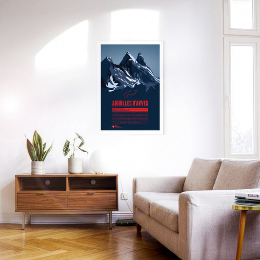
The rock spires of the Aiguilles d’Arves rise in the Maurienne, east of Grenoble. The southern peak, the Aiguille Méridionale, is the highest of them. It is followed by the Aiguille Centrale, just one metre lower, and, set slightly apart further north, the Aiguille Septentrionale, also known as ‘Tête de Chat’ – cat’s head. Since many are drawn to the famous and popular Écrins massif to the south, the Aiguilles d’Arves have become something of an insider tip for anyone looking for quieter mountain and climbing tours.
Between Monte Rosa to the south and the Mischabel group to the north, the Rimpfischhorn rises as the highest point of the Allalin group. Its rocky ridge climbs slowly from the north to the highest summit in the south. Seen from the south the mountain therefore appears as a steeply rising triangle of stone, while from the west and east it shows its rocky spikes. The Rimpfischhorn is suited both to high alpine tours in summer and to ski tours in winter.
The Titlis lies at the centre of the Uri Alps and is the highest point of a mountain chain some 20 kilometres long. While the Titlis, with its curved summit, drops away sharply to the east and south in impressive rock faces, to the north it slopes gently down towards the municipality of Engelberg. Thanks to cable-car access and attractions such as the ‘Titlis Cliff Walk’, it is a very popular and much-visited mountain, whether for walking in summer or skiing in winter.
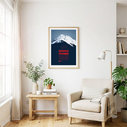
The Ennskraxn is not the highest mountain in Salzburg’s Kleinarl valley, but it is one of the most striking summits in the area. It is part of the Radstadt Tauern, a western subgroup of the Niedere Tauern. Locals simply call the mountain ‘Krax’. The Enns, Austria’s longest inland river, rises east of the summit. Trips around the mountain are especially colourful in early summer, when the hairy alpenrose – known locally as ‘Almrausch’ – is in bloom.
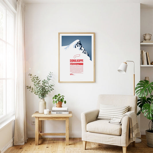
The Signalkuppe, also called Punta Gnifetti in Italian, is a summit in the Pennine Alps on the border between Italy and Switzerland, and a subsidiary peak of Monte Rosa. The mountain is named after ‘the signal’, a prominent gendarme on the east ridge, which is called the Cresta Signal. The first ascent was made by Giovanni Gnifetti, a parish priest from Alagna Valsesia. The highest building in Europe, the Capanna Margherita, stands on the summit; work began in 1890 with the support of the Italian Crown, and Queen Margherita opened it in 1893.
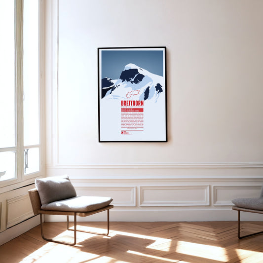
The Breithorn is a mountain range in the Pennine Alps whose highest summit carries the same name and lies on the border between Switzerland and Italy. It sits on the main chain of the Alps, roughly halfway between the Matterhorn and Monte Rosa and east of the Theodul Pass. Most of the massif is glaciated and includes several subsidiary peaks, all of them east of the main summit: the Central Breithorn, the western Breithorn Twin, the Gendarme and the Roccia Nera.
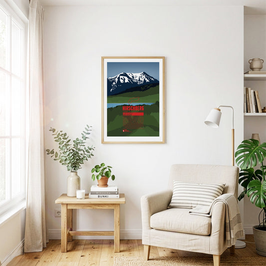
South of the Tegernsee rises the Hirschberg, with its main summit in the west and a fore-summit about 15 metres lower in the east. Despite its comparatively modest height, the mountain is visible from far to the north and greets the inhabitants of the Bavarian Alpine foreland. The summit can be reached on various walking paths and offers an excellent view that in good weather stretches from the Roßstein across the Zugspitze to the Großglockner.
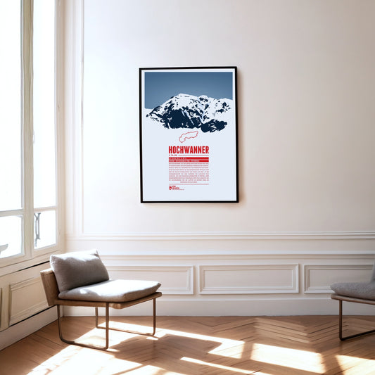
The Hochwanner, on the border between Bavaria and Tyrol, is Germany’s highest point outside the Zugspitze massif. Its impressive north face drops more than 1400 metres towards the Reintal. The first ascent was made in 1870 by what is now the normal route from the south, out of Tyrol. In the summer months there is a good chance of meeting the marmots that live here during the climb. At the top, a fine view opens up over neighbouring mountains such as the Alpspitze to the north and the Mieming Chain to the south.
Between the Splügen Pass and Chur, the Piz Beverin rises in the eastern Adula Alps. The relatively free-standing summit offers an excellent view. Besides walking paths, climbing routes of varying difficulty lead up the Piz Beverin, and the mountain is a popular ski-touring destination. The Beverin nature park surrounds it: alongside the ibex, the heraldic animal of Grisons, a wolf pack lives here too.
The Parseierspitze is the only three-thousand-metre peak in the Northern Limestone Alps and the highest mountain of the Lechtal Alps. It rises above the Inn valley as a jagged tower of rock. The name of the mountain and of the Parseier valley probably goes back to the Romance word ‘presür’, which described the gate of an alpine pasture.
The Monte Disgrazia is a chameleon. Seen from the north-west or south-east, it appears as a sharp, rugged, unconquerable horn. From the north-east, by contrast, the peak looks like an elongated plateau. The reason is the multi-peaked summit wall, which runs in an almost perfectly north-westerly direction and so allows very different views.
The Monte Civetta in the province of Belluno towers above the Cordévole valley and the village of Alleghe. ‘Civetta’ means owl in Italian and goes back to the earlier notion that such a mighty mountain could only be conquered in flight. That is due above all to its north-west face, as steep as it is vast: more than 1000 metres high and three kilometres wide, it is one of the largest rock faces in the Dolomites.
The Linker and Rechter Fernerkogel are two peaks north-east of the Wildspitze, with the Mittelbergferner glacier between them. The Linker Fernerkogel is a popular tour destination in both summer and winter. The normal route leads to the summit from the north, starting at the Braunschweiger Hütte. The area is also used for glacier mountaineering courses.
Regular price
from 19 €
Regular priceSale price
from 19 €
Books, maps and more.
About the Alps and the world.