What defines a mountain? A mountain rises above its surroundings. At the same time, not every small elevation is considered a mountain. So what criteria decides what is and what isn’t a mountain? With the help of geography, a mountain can be described objectively. The most important feature of a mountain is its height above sea level. Mountaineers often strive to conquer certain thousand-metre markers. The topographic prominence measures the independence of a summit. Depending on its location, a mountain in the Alpine foothills that is only a few hundred metres high can seem more impressive than a sub peak with a height of over 4 000 metres in the Mont Blanc or Monte Rosa massif.
Mount St. Helens ist ein aktiver Stratovulkan in der Kaskadenkette, nahe der Westküste der USA. Der schwere Ausbruch des Vulkans am 18. Mai 1980 war das verheerendste vulkanische Ereignis der US-Geschichte und führte zum Tod von 57 Menschen. Die Nordflanke rutschte dabei ab und so verlor der Berg gut 400 Meter an Höhe. In den Sprachen der lokalen Ureinwohnern ist Mount St. Helens als Lawetlat'la (Cowlitz) beziehungsweise Loowit or Louwala-Clough (Klickitat) bekannt.
Mount Edgecumbe is a dormant volcano and the highest mountain on Kruzof Island in the southeast of Alaska. In the native Tlingit language the mountain is named L'ux which can be translated as flashing or blinking. Mount Edecumbe got international attention in course of one of the largest April Fool jokes in history when on 1st April 1974 Oliver Bickar alarmed the population in the surrounding settlements who were in fear of an eruption when Bickar had actually only set dozens of tires on fire.
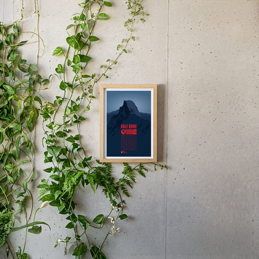
Half Dome is a prominant rock tower in Yosemite National Park. Its impressive northwest face rises almost 1500 meters (5000 feet) above Yosemite Valley. The mountain is a very popular photo motif as well as a paradise for climbers. While Half Dome was declared absolutely inaccessible for humans in 1865 only ten years later George Anderson was the first to reach the summit after successfully climbing the rock wall. In 1957 the first grade VI climb in North America was achieved at Half Dome.
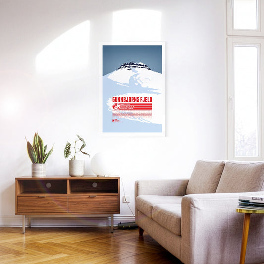
Gunnbjørn Fjeld ist der höchste Berg Grönlands und die höchste Erhebung nördlich des Polarkreises. Der ist nach Gunnbjørn Ulvsson benannt, dem ersten europäischen Entdecker Grönlands. Als Teil der Watkins Range erhebt sich Gunnbjørn Fjeld an der Ostküste der Insel. Aufgrund der abgeschiedenen Lage werden nur selten Aufstiegsversuche unternommen. Die erste nachgewiesene Besteigung gelang einer britischen Expedition 1935. Erst über 35 Jahre später, 1987 wurde der Gipfel zum zweiten Mal erreicht.
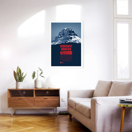
Crowsnest Mountain is a massive rock tower on the eastern side of the Rocky Mountains. The monolith raises south of the Seven Sisters. Further south is highway 3 which offers some spectacular views of the mountain. The name goes back to the native Cree who named the rock after the black ravens - not crows - which were nesting in the area.
Mexikos dritthöchster Berg, Iztaccihuatl oder kurz Ixta, erhebt sich nördlich des Popocatépetl zwischen der Hauptstadt und Puebla. Der Name des Bergs kann mit „weisse Dame“ übersetzt werden, denn von Osten oder Westen aus gesehen erscheint das Profil des Bergrückens wie eine liegende Frau mit Kopf, Brust, Knien und Füssen. Die besten Wetterbedingungen für den Aufstieg auf den Berg herrschen im Frühjahr. Aufgrund der Höhe über 5000 Meter sollte dabei ausreichend Zeit für die Akklimatisierung eingeplant werden.
The Watkins Range is the highest mountain range on Greenland, including the island's highest mountain Gunnbjørn Fjeld. Other notable three-thousanders of the range include Gunnbjørn Dome (3682 m) and Gunnbjørn Cone (3669 m). The mountains in the Watkins Range are so-called “nunataks”, rocks which emerge from an area which is otherwise covered entirely by ice and glaciers.
Popocatépetl is the second-highest mountain in Mexico and one of the country's most active volcanoes. The partly glaciated stratovolcano rises between Mexico City and Puebla and shapes the skyline of both cities. According to an Aztec legend, the volcano is the tomb of the former tribal leader Popocatépetl transformed into a mountain, while the neighbouring sister volcano Iztaccíhuatl is the tomb of his beloved.
The Cordillera de Guanacaste is a mountain range in northern Costa Rica close to the Nicaraguan border. The range includes a considerable number of active and dormant stratovolcanoes. The most famous one is also one of the highest volcanoes of the range: the Arenal volcano. It last erupted in 1968, destroying two villages and covered the entire region with volcanic ash. Arenal is still active today, even though the danger of another fatal eruption is not considered very high in the foreseeable future.
Pico de Orizaba is also known as Citlaltépetl (star mountain) or Iztactépetl (white mountain). It is not only Mexico's highest and North America's third highest peak, but also the highest volcano on the continent. On clear days the snow-covered mountain top is visible in distances of more than 100 kilometers. Several glaciers can be found on the slopes of Pico de Orizaba, among them Mexico's largest glacier, Gran Glaciar Norte.
Organ Needle is the highest peak of the Organ Mountains in southwestern New Mexico. These mountains consist mainly of granite stone, which in the north formed steep pointed summits, called “The Needles”. Reaching the top of Organ Needle is quite challenging and usually involves free pathfinding and scrambling.
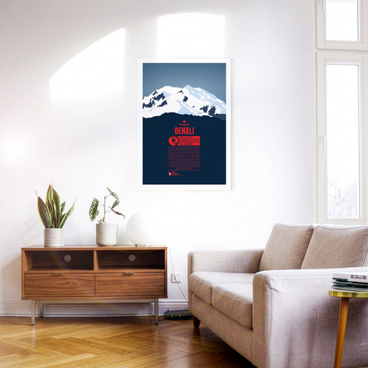
Denali is North America's highest mountain, and the third most prominent peak on the planet. It was long known as Mount McKinley before formally being named Denali in 2015, the native name of the mountain, meaning “the tall one”. The first successful summit ascent was recorded in 1913. Today the mountain is climbed frequently. Not only is it one of the Seven Summits. Its cold temperatures and harsh winds also make it a great destination for climbers who want to prepare for Himalaya expeditions.
Wheeler Peak is the highest mountain in New Mexico, situated in the Sangre de Cristo Mountains, the southernmost Rocky Mountains subrange. First known as Taos Peak, the mountain was renamed in 1950, after George Montague Wheeler, a cartographer and explorer. Only 15 miles southwest skiers can enjoy the slopes of Taos Ski Valley.
Wheeler Peak is Nevada's second highest summit, being only 82 ft (ca. 25 m) lower than Boundary Peak, but more prominent than the latter. It is also the highest mountain of the Snake Range. As the mountain with the same name in New Mexico, it is named after George Montague Wheeler, who explored the area in the 19th century. The mountain is part of the Great Basin National Park, which was established in 1986.
The Three Sisters are a group of three volcanoes, made up of Oregon's third-, fourth- and fifth-highest mountains, all having an elevation over 10000 ft (3000 m). Being very close to each other, they appear as an entity. The chapter of the Methodist church of Salem named the three summits from north to south Faith, Hope and Charity in the 1840s. Nearby Mount Bachelor, lying much more remotely by itself, owes its name to the Three Sisters. Today the three mountains are a popular destination for climbers. Even though the South Sister is the highest of the three summits, the North Sister is considered the most dangerous to climb.
Mount Wrightson in southern Arizona is the highest peak in the Santa Rita Mountains, south of Tucson. It was named after William Wrightson, who was killed in the Battle of Fort Buchanan 1865 by Apaches. In contrast to the much more massive Mount Lemmon, north of Tucson, Mount Wrightson has a characteristic pyramid-shaped top. It can be reached fairly easily with a 11 to 14 mile hike. Once at the summit one is rewarded with the best view over the area, overlooking much of southern Arizona and over the border to Mexico.
With a height of 14505 feet (4421 m) Mount Whitney is the highest mountain of the Sierra Nevada, California and the contiguous United States. The summit is less than 90 miles away from North America's lowest point in Death Valley (282 ft below sea level). The challenging Badwater Ultramarathon leads athletes over 135 miles from Badwater in Death Valley to Whitney Portal on 8360 feet (2548 m). Whitney Portal is the starting point for many climbers on their way to Mount Whitney's summit.
Mount Vancouver is part of the Saint Elias Mountains and lies on the US-Canadian border. It has three summits. The north summit is the highest and lies in the Yukon. The international border runs along the south summit, also known as “Good Neighbor Peak”. The mountain was named after the British George Vancouver, who explored the Alaskan coast in the late 18th century. It was first summited in 1949. Due to its remote location summit attempts occur rarely today.
Mount Timpanogos in northern Utah is the second highest mountain of the Wasatch Range in the Rocky Mountains. The name comes from the native Ute tribe, and can be translatet as “rock and water mouth” or “rock and canyon”. The massive mountain's impressive appearance is due to its long ridge of about 7 miles, with many peaks being above 11000 feet (3300 m). Though not completely risk-free, reaching Mount Timpanogos' top requires no particular climbing skills which makes it one of the most frequently climbed summits in the Rocky Mountains.
Mount Shasta in northern California is the second highest summit of the Cascade Range and the second highest volcano in the United States. Its last eruption dates back to 1786. The first recorded ascent of the mountain was made in 1854. Today the summit is climbed frequently, although only about a third of the attempts are successful. The Mt. Shasta Ski Park is situated about 6 miles (10 km) south of the summit.
Lying on the US-Canadian border Mount Saint Elias is the second highest mountain of both the USA and Canada, as well as the second highest peak of the Saint Elias Mountains. The first European to see the mountain was the Danish Vitus Bering, who explored the area for Russia. Today it is unclear, whether Bering named the mountain himself, or if this was done by geographers later. Mount Saint Elias was first climbed in 1897. The ascent is extremely difficult, many attempts fail due to bad weather and bad visibility. In 2007 an Austrian expedition managed to ski down all the way from the summit to Icy Bay on the Gulf of Alaska on their second attempt.
Mount Robson is the highest mountain in the Canadian Rocky Mountains and the second highest mountain in British Columbia, being entirely in the province. It steeply rises up almost 10000 feet (3000 m) from Kinney Lake on the south-west side to the summit. Whether the mountain's name goes back to Colin Robertson, a fur trader of the North West and Hudson Bay Company, is assumed, but not confirmed with certainty. The native Secwepemc call the mountain “Yuh-hai-has-kun” (“the mountain of the spiral road”). Mount Robson was first climbed in 1913. Reaching the summit is quite difficult and requires high climbing skills, with only about 10% of the attempts being successful, even though the mountain is not particularly high.
Mount Rainier is a volcano and the highest mountain in the Cascade Range and the highest point in the state of Washington. George Vancouver named the mountain after British admiral Peter Rainier. The native Salish called the mountain “Tacoma” or “Tahoma”. There are different interpretations about the meaning though, “mother of waters” being one of these. After the Denali was renamed in 2015, disputes over also renaming Mount Rainier became stronger again. Mount Rainier is home to the largest glaciers in the US outside of Alaska. When attempting to reach the summit crossing these is one of the many obstacles one has to face.
Mount Logan is Canada's highest mountain and the second highest peak of North America, making it one of the Seven Second Summits. It was only discovered in 1890 and named after Canadian geologist Sir William Edmond Logan, one year later. Summitting Mount Logan is generally considered a bigger challenge then the ascent of Denali. The remote location, extreme cold and storms are the biggest obstacles. The first successful summit attempt took place in 1925.
Mount Hood is Oregon's highest mountain and the fourth highest peak of the Cascade Range. It is situated about 50 mi east of Portland, close to the Oregon-Washington state border. The mountain is a stratovolcano. Its last major eruption dates back to 1781 and 1782 and it is still considered potentially active. The characteristic snow-covered top of the mountain is made up of glaciers and snowfields, which makes it difficult to determine the exact height of the mountain. There are five alpine ski resorts located at Mount Hood.
Mount Grinnell in Glacier National Park, Montana, lies approximately in the middle between Mount Gould in the south and Mount Wilbur in the north. It is named after George Bird Grinnell, one of the first white explorers of the area. Grinnell was also one of the main driving forces in establishing Glacier National Park in 1910. More famous than the main summit is Grinnell Point, a subpeak of the mountain, which is often photographed from the Many Glacier Hotel on Swiftcurrent Lake.
Mount Gould, in the Glacier National Park, Montana, is the highest mountain of the Garden Wall. While not being particularly noticeable, seen from the west, the view from the east is very impressive, where the mountain rises up about 4000 (ca. 1200 m) feet over Grinnell Lake and Lake Josephine. Accordingly the normal route to the summit starts on the west side. It was also used during the first recorded ascent, made in 1920.
Mount Fay is the highest mountain in the Valley of the Ten Peaks, on the border between Alberta and British Columbia. In 1902 it was named after Charles E. Fay, a pioneer mountaineer in the Canadian Rockies. Fay was supposed to have the honour of being the first to summit “his” mountain. But Christian Kaufmann and Gertrude Benham, one of the few women alpinists of the turn of the century, beat him to it and made the first recorded ascent of Mount Fay on 19th July 1904.
Mount Fairweather in the Saint Elais Mountains lies mostly in Alaska. Its peak is on the border to Canada though, which makes it the highest point in the province of British Columbia. Being only about 12 miles (20 km) east of the Pacific coast, Mount Fairweather has a very high prominence of almost 13000 feet (about 4000 m). According to a legend of the Tlingit natives Mount Fairweather or “Tsalxhaan” and Mount Saint Elias were originally next to each other, but separated after having an argument. This is why the Tlingit call the mountains in between the “Children of Tsalxaan”.
Mount Elbert is the highest mountain in the Rocky Mountains and in Colorado. It is also the second highest peak in the contiguous United States after Mount Whitney. In spite of these facts it is one of the less famous mountains in the Rockies and among the US state high points. It is named after Samuel Hitt Elbert, who was governor of the Territory of Colorad from 1873-1874, two years, before Colorado became the 38th US state.
Mount Columbia is the highest mountain of Alberta and the second highest summit of the Canadian Rockies. It lies on the border between Alberta and British Columbia, with the peak being in Alberta, though. The Columbia Icefield, south of the summit, made up of eight major glaciers lies on the continental divide. From there rivers flow into the Arctic Ocean, into the Hudson Bay and into the Pacific Ocean.
Mount Baker in northern Washington is a volcano in the Cascade Range. It his heavily glaciated and one of the snowiest mountains in the world. George Vancouver named the mountain after the Royal Navy officer Joseph Baker. Being relatively close to the coast, Mount Baker is visible from Victoria on Vancouver Island, from Vancouver and from Seattle. On the mountain's eastern flank is the Mount Baker Ski Area.