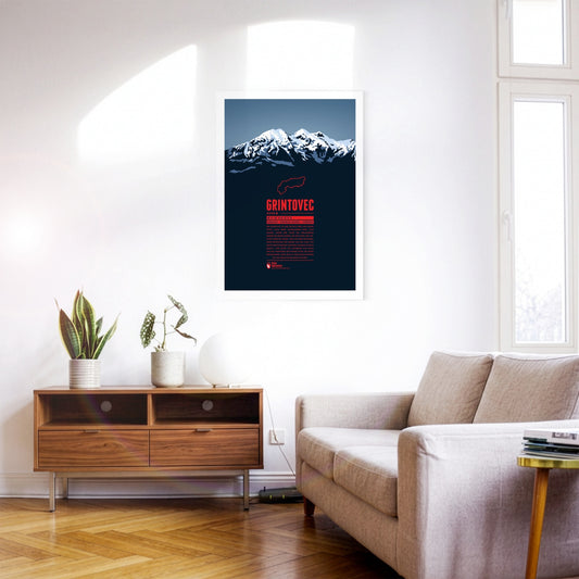
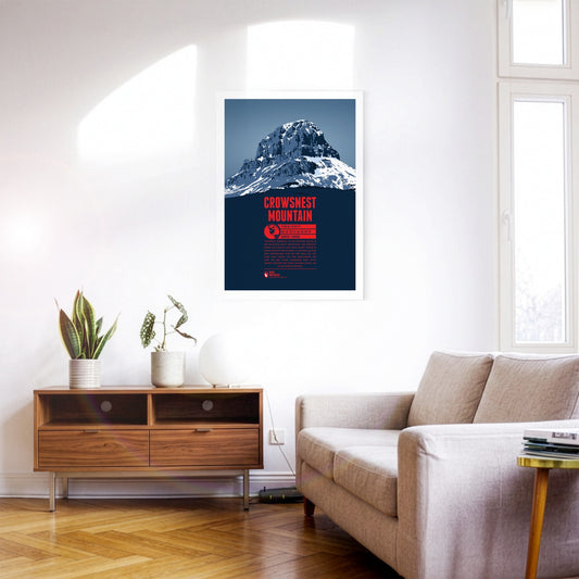
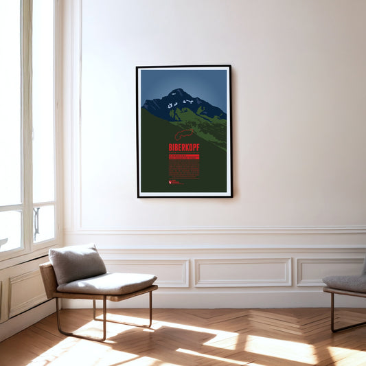
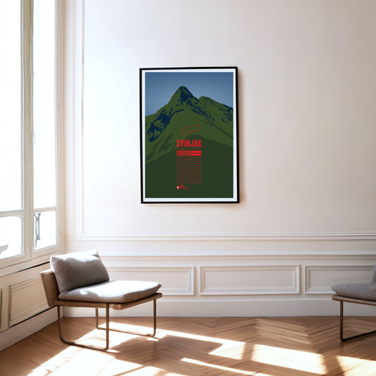
Grintovec is the highest peak of the Kamnik–Savinja Alps. While it is assumed that farmers, herdsmen or hunters from the area were the first to reach the summit of Grintovec the first documented ascent was achieved by the botanist Giovanni Antonio Scopoli om 1759. The mountain top offers a panorama view of the Kamnik–Savinja Alps and when weather conditions are good to the south one can even spot the Adriatic Sea.
Crowsnest Mountain is a massive rock tower on the eastern side of the Rocky Mountains. The monolith raises south of the Seven Sisters. Further south is highway 3 which offers some spectacular views of the mountain. The name goes back to the native Cree who named the rock after the black ravens - not crows - which were nesting in the area.
The Biberkopf (beaver's head) rises at the end of the main ridge of the Allgäu Alps and is considered to be Germany's most southern mountain. The border to Austria runs along the distinctive summit. The name of the mountain goes back to larger beaver colonies that populated the nearby Lechtal and the surrounding high moors. Beavers are also part of the traditonal womens' costumes of the area which include beaver hats.
Southwest of Oberstdorf, on the border between Bavaria and Vorarlberg the Söllereck rises as the northernmost summit of the Fellhorn ridge. The mountain is thus situated between the entries to the valleys Kleinwalsertal in the west and Stillachtal in the east. Via the Söllereckbahn aerial lift one reaches the summit station on 1358 meters. In the winter it is part of the ski area Oberstdorf / Söllereck.
The Nebelhorn is a summit in the Daumen Group of the Allgäu Alps, rising east of Oberstdorf. The aerial lift Nebelhornbahn brings passengers almost directly onto the summit, making it the highest aerial lift of the Allgäu. Even the Nebelhorn Trophy, a yearly international figure skating competition at Oberstdorf is named after the mountain.
The pyramid-shaped summit of Svinjak rises in the Triglav national park. Because of its striking shape it is also called the ‘Matterhorn of Bovec’, having become the landmark of the village at its foot. Despite its comparatively modest height, Svinjak is a popular viewpoint: from the summit you can see the Bovec basin, the Soča valley and Slovenia’s highest peak, Triglav.
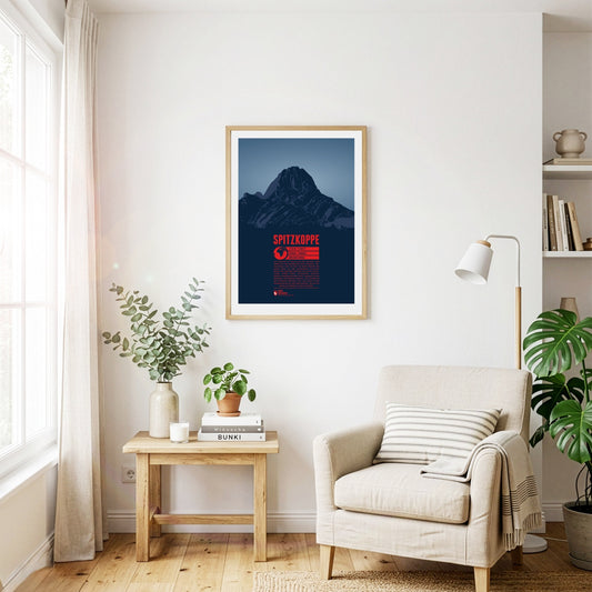
The Spitzkoppe may not be Namibia’s highest mountain, but it is probably its most famous. It rises impressively some 700 metres out of the surrounding plain in the middle of the Namib Desert. The inselberg was formed by volcanic activity around 100 million years ago. Its pyramid-like summit has earned it the nickname ‘the Matterhorn of Namibia’. Climbing on the Spitzkoppe is best in the southern hemisphere’s winter months, as the rock heats up too much in summer.
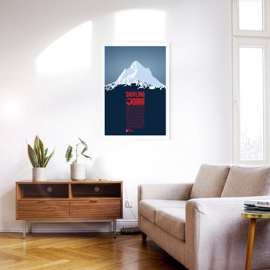
Shivling is a striking pyramid-shaped summit in the north Indian part of the Himalayas. The name goes back to the Hindu deity Shiva; British mountaineers also called the mountain ‘Matterhorn Peak’. The Gangotri Glacier, one of the largest in the Himalayas, lies east of the mountain. The Bhagirathi, one of the source rivers of the Ganges, rises here, which is why a well-known pilgrimage route leads into the area. Shivling was first climbed in 1974 by an expedition of the Indo-Tibetan Border Police.
The pointed summit of Mount Aspiring rises in the Southern Alps on New Zealand’s South Island, west of Lake Wanaka. The Māori call the mountain Tititea, meaning ‘glittering peak’. Because of its shape it is also known as the ‘Matterhorn of the South’. Surrounded by glaciers in the national park of the same name, Mount Aspiring is now part of a UNESCO World Heritage Site. The mountain is also a popular destination for climbing and winter sports.
Nur wenige Menschen haben bisher den Gipfel des Jirishanca, des „Kollibrischnabels aus Eis“ erreicht. Die steil aufragende Felspyramide in der Cordillera Huayhuash ist auch als das „Matterhorn der Anden“ bekannt. Im Juli 1957 gelang den Österreichern Toni Egger und Siegfried Jungmair die Erstbesteigung über die Nordostwand. Diese Route wurde 1969 zum zweiten und bisher letzten mal erfolgreich begangen. Im selben Jahr gelang auch der erste Aufstieg über die Westwand.
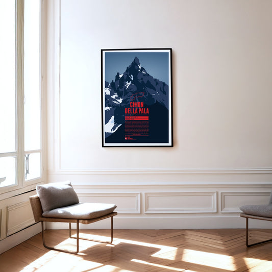
The summit of the Cimon della Pala is a striking rock pyramid, which is why the mountain is also known as the ‘Matterhorn of the Dolomites’. There is a particularly fine view of the summit and the surrounding peaks of the Pala group from the Passo Rolle at almost 2000 metres. The normal route to the top follows the east ridge, but was not climbed for the first time until 1989. The first ascent of the mountain in 1870, by contrast, took the line up the north face.
Even though Patscherkofel is neither a particularly high peak in its area, nor considered very beautiful, its location south of Innsbruck make it the home mountain of the city. The transmission tower “Sender Patscherkofel” on the top rises another 67 meters above the summit. Patscherkofel became known to an international audience during the Olympic Winter Games of 1964 and 1976 when the Alpine ski competitions took place on the slopes of the mountain.
The Großer Krottenkopf is situated in Tyrol, south of the Bavarian town Oberstdorf. It is the highest point of the Hornbach Chain and the highest summit of the entire Allgäu Alps. The normal route to the Krottenkopf leads from the Alpine club hut Kemptner Hütte via the col Krottenkopfscharte, about 300 meters below the summit on the southern ridge of the mountain.
The Trettachspitze is the highest mountain of the Allgäu Alps to lie entirely in Bavaria. Because of its appearance, the striking summit is also called the ‘Matterhorn of the Allgäu’. The ascent of the Trettachspitze is reserved for experienced climbers; the easiest line is the route over the north-west ridge. Various routes on the mountain’s west face are climbed particularly often.
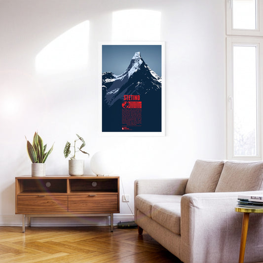
Stetind is one of the best-known mountains in Scandinavia and was voted Norway’s national mountain in 2002. An almost perfect obelisk, it is sometimes called ‘the Matterhorn of Scandinavia’. Although the mountain is not especially high, its northerly position and the harsh climate and weather make attempts on it a difficult undertaking. After several failed attempts, Stetind was climbed for the first time in 1910.
Kebnekaise is Sweden's highest mountain. It is situated in the far north of the country, about 150 kilometers north of the Arctic Circle. The mountain consists of two main summits. For a long time the southern peak (Sydtoppen) was the higher of the two. It was highly glaciated and since the ice at the summit strongly decreased in recent years, nowadays the mostly ice-free northern peak (Nordtoppen) is the high point of the massif.
The rocky spires of the Rosengarten group rise to the east of Bolzano in the Dolomites. Its highest summit is the Kesselkogel. At sunset, the rock of this popular viewpoint glows in magnificent shades of red – a phenomenon known as alpenglow, or enrosadira in Ladin. Legend surrounds the mountain: the dwarf king Laurin is said to have cursed the Rosengarten after losing a battle for the king's daughter. The "Gartl" was to be visible neither by night nor by day, which is why today it appears only at dusk, during the alpenglow.
Uluru is one of Australia's most famous landmarks, situated in the center of the country, southwest of Alice Springs. The British first named the mountain Ayers Rock. Because of its huge spiritual importance for the Anangu, the native inhabitants of the area, in 2019 climbing Uluru was permanently banned. Uluru is known for its changing colors throughout the day, especially during dusk and dawn. Another phenomenon can be observed during the rare heavy rainfalls in the area when for a short time the walls of Uluru become waterfalls.
The major landmark of Cape Town towers in the west over the second biggest city of South Africa. The three kilometer long summit plateau is characteristic as are the neighboring peaks Lion's Head in the south and Devil's Peak in the north. Since 1929 a funicular airway leads onto Table Mountain which can also be accessed via a number of different hiking trails which both contribute to making the mountain one of the most popular tourist destination in all of South Africa.
The Mythen are the iconic landmarks of Schwyz and are located east of the capital of the canton with the same name. The highest summit is the Grosser Mythen in the south. In the north the lower Kleiner Mythen rises and even further north is its sub-peak Haggenspitz. While hiking trails lead up to the Grosser Mythen the two lower summits can only be reached via climbing passages.
The Tegelberg rises in the Allgäu near Füssen. The highest summit of the massif is the Branderschrofen. The Tegelberghaus lies about 150 meters below the summit and can be accessed with the cable car Tegelbergbahn. Close to the mountain station is a popular starting point for paragliders who appear in large numbers during the warm season. On the western foot of the mountain is Hohenschwangau with the world famous Neuschwanstein Castle.
The Montserrat mountain massif is situated in the center of Catalonia. The characteristic and impressive appearance of the mountain chain is due to the red sand stone and the many rock needles. The high point of Montserrat is Sant Jeroni. Well-known is the Benedictine Abbey Santa Maria de Montserrat in the east, which was tightly squeezed to the rock. Several air funiculars and the funicular railway Cremallera de Montserrat transport visitors onto the mountain nowadays. It is also a popular destination for hiking, climbing, or biking.
Mexico’s third-highest mountain, Iztaccihuatl or Ixta for short, rises north of Popocatépetl between the capital and Puebla. The name can be translated as ‘white lady’, because seen from the east or west the profile of the ridge looks like a reclining woman with head, breast, knees and feet. The best weather for the ascent comes in spring. Given the altitude of more than 5000 metres, enough time should be allowed for acclimatisation.
The Watkins Range is the highest mountain range on Greenland, including the island's highest mountain Gunnbjørn Fjeld. Other notable three-thousanders of the range include Gunnbjørn Dome (3682 m) and Gunnbjørn Cone (3669 m). The mountains in the Watkins Range are so-called “nunataks”, rocks which emerge from an area which is otherwise covered entirely by ice and glaciers.
The Rax massif is located north of the Semmering Pass and is part of the Rax-Schneeberg group. The highest point of the mountain plateau is the Heukuppe. In 1894 Fritz Benesch developed the first grading system for alpine climbs at the Rax. In addition, after a disastrous avalanche the world's first mountain rescue service was founded here in 1896.
Popocatépetl is the second-highest mountain in Mexico and one of the country's most active volcanoes. The partly glaciated stratovolcano rises between Mexico City and Puebla and shapes the skyline of both cities. According to an Aztec legend, the volcano is the tomb of the former tribal leader Popocatépetl transformed into a mountain, while the neighbouring sister volcano Iztaccíhuatl is the tomb of his beloved.
The perfect volcanic cone of Cotopaxi rises in the Andes close to the equator. The mountain is one of the highest active volcanoes on Earth. Over 80 eruptions have been documented over the past 500 years, with the last major eruption from 1903 to 1904. The first European who tried to climb to the summit was Alexander Humboldt in 1802. He had to turn around though after reaching a height of about 4500 meters. Thus 70 years later Wilhelm Reiss and Angel Escobar achieved the first documented ascent of Cotopaxi.
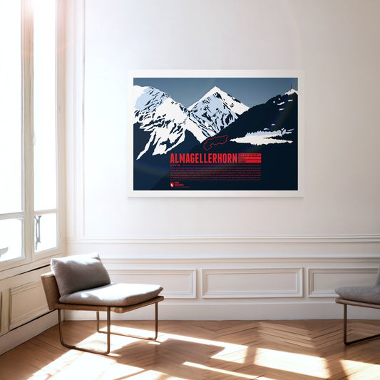
Lying close to many four-thousand-metre peaks of the Valais Alps, the Almagellerhorn is not the most conspicuous summit in the region. Yet the shapely mountain, which appears as a perfect rock pyramid from Saas-Fee, deserves all the attention. The ascent, which is not overly difficult, is worth it too: from the summit of the Almagellerhorn you have a splendid view of the surrounding peaks and ranges such as Weissmies to the north, Stellihorn to the south and, of course, the peaks of the Mischabel group and Monte Rosa to the west.
Olympus Mons on Mars is the highest known mountain on the planets of our solar system. The shield volcano has a height of about 22 kilometers above the average ground level of Mars. It's base diameter is almost 600 kilometers wide. From a geological point of view Olympus Mons is still relatively young, and probably evolved about two million years ago.
South of the Chiemsee lake the Kampenwand rises with its distinctive rock mountain top, resembling of a rooster's comb (German: Kamm). This makes the mountain easy to spot, even from greater distances. Not on the main summit, but on the four meters lower east summit is the highest summit cross in the Bavarian Alps with a height of 12 meters. In winter the Kampenwand Cable Car transports skiers into the winter resort Kampenwand–Aschau on the northeastern slopes. Ascending the main summit, about 200 meters above the mountain station, is possible by hiking with only short climbing passages. But Kampenwand has much more to offer for climbers, mountainbikers, and freeriders.
The Brocken is the highest peak of the Harz and is also considered to be the high point of Northern Germany. Since 1899 the summit can be accessed via the Brocken Railway. The mountain, which is often covered in fog, is also known under the name Blocksberg and lots of myths and legends are known about the Brocken. Some said it was a gathering point for witches. The optical illusion Brocken spectre, usually occuring during foggy periods, also played its part for the creation of many of the stories.
The Nordkette, also known as Northern Chain or Inn Valley Chain, is the southernmost mountain chain in the Karwendel. Its highest summit is Kleiner Solstein, which is nearly 100 meters higher than neighbouring Großer Solstein. The via ferrata Innsbrucker Klettersteig leads over seven summits of the chain, from Seegrubenspitze via Langer Sattel to the summit named Frau Hitt.
Korvatunturi lies in the Finnish part of Lapland, on the border to Russia. It is not so much its height, but rather the distinctive, sharp main summits which set the mountain apart from the surrounding area. Korvatunturi is especially well-known due to a popular Finnish story from the 1920s. According to the tale the mountain is the home of Joulupukki, the Finnish equivalent of Father Christmas.
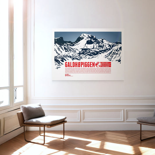
Galdhøpiggen is the highest summit in Norway and the highest mountain in all of Scandinavia, which makes it an extremely popular destination for climbers. Three larger glaciers cover the northern, western and southern sides of the summit, so the ascent route from the east is the easiest and requires no technical climbing. For a long time Glittertind, only a few kilometres to the east, was considered the higher of the two mountains. Melting glaciers at Glittertind’s summit have cost it so much height, however, that it is now only Norway’s second-highest mountain.
Marmolada is known as the Queen of the Dolomites and the highest mountain of the range. The Ghiacciaio della Marmolada on the north face is the last major glacier of the Dolomites. The area is especially popular for hiking. The so-called “Dream Path” from Munich to Venice is one of the famous routes running around the mountain.
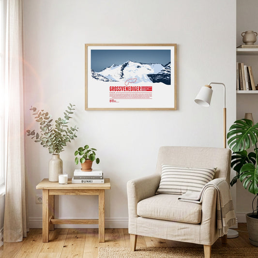
The highest summit of the Austrian state Salzburg lies on the border to Tyrol and is the high point of the Venediger Group, the westernmost mountain range of the High Tauern. The Großvenediger's characteristic summit is determined by its glaciers and the prominent ridges, running along towards all four cardinal points of the compass.