Mount Edgecumbe is a dormant volcano and the highest mountain on Kruzof Island in the southeast of Alaska. In the native Tlingit language the mountain is named L'ux which can be translated as flashing or blinking. Mount Edecumbe got international attention in course of one of the largest April Fool jokes in history when on 1st April 1974 Oliver Bickar alarmed the population in the surrounding settlements who were in fear of an eruption when Bickar had actually only set dozens of tires on fire.
As one of the western summits of the Daumen Group the Rubihorn and its summit cross tower west of the Nebelhorn and north of the Schattenberg. The mountain is named after the town Rubi, which is situated north of Oberstdorf. The mountain top offers a stunning view over the Iller Valley and the surrounding summits. One of the most scenic routes to the summit leads from the east along the picturesque Gaisalpsee.
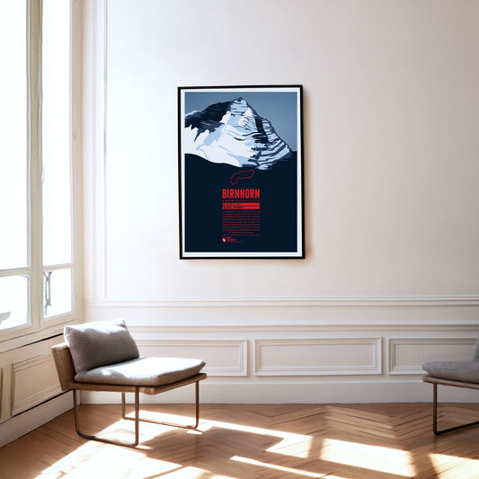
The Birnhorn is the highest point of the Leoganger Steinberge and one of the 30 most prominent summits in the Alps. It rises almost 2000 metres above the valley of the Leoganger Ache to its south. The mountain’s south-east face, around 1400 metres high, is one of the highest rock faces in the Eastern Alps and is even compared to the famous east face of the nearby Watzmann.
Kriváň rises to almost 2500 metres in the High Tatras, the highest part of the Carpathians. The mountain owes its name to its curved summit shape: krivý means crooked in Slovak, and in German the mountain is also known as Krummhorn. Kriváň is sometimes called ‘the Matterhorn of Slovakia’ and has repeatedly been voted the country’s most beautiful summit. Since the 19th century it has become one of Slovakia’s national symbols.
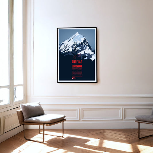
While the Marmolada is regarded as the queen of the Dolomites, Antelao is their king. Unusually for this mountain group, the peak rises majestically as a free-standing rock pyramid to the south-east of Cortina d'Ampezzo. Together with Monte Pelmo to the west, the second-highest summit of the Dolomites forms a gigantic gateway into the Val di Cadore.
Lhotse ist der vierthöchste Berg der Erde. Mit einer Schartenhöhe weit unter 1500 Meter ist der Lhotse der einzige der 14 Achttausender, der nicht zu den sogenannten ultraprominenten Gipfeln gezählt wird. Dies ist seiner Nachbarschaft zum Mount Everest zu verdanken, mit dem er über den Südsattel verbunden ist. Die Erstbesteigung des Lhotse erfolgte 1956 drei Jahre nach der des Everest. Die erste Besteigung des Nebengipfels Lhotse Middle gelang erst 2001, wodurch dieser fast 50 Jahre lang der höchste unbestiegene Punkt der Erde war.
The Rigi is a mountain massif with the highest peak Rigi Kulm. It is located between Lake Lucerne, Lake Zug and Lake Lauerz and offers a spectacular view over large parts of the Swiss Alps. This is one of the reasons why the first mountain railway in Europe, the Vitznau-Rigi-Bahn, was build here in 1871. Rigi has attracted famous guests for centuries: Twain and Goethe visited the massif and Tolstoi even described the view as “the most beautiful in the world”.
Between the Eiger and the Jungfrau, the Mönch completes the impressive trio in the Bernese Oberland. From the top station of the Jungfrau railway it is just over 600 metres of ascent to the summit, though the climb involves some technical challenges. Only in 1996 did re-measurement show that the mountain is nine metres higher than previously assumed. Geldings – ‘Münche’ in the local dialect – were once summered on pastures on the mountain, and ‘Münchenberg’ later became Mönch.
The Ponta do Pico, often simply abbreviated to Pico, is a majestic stratovolcano on the Azores island of the same name. With its 2351 meters it is the highest mountain in Portugal and the mid-Atlantic ridge. The name means "summit" and its impressive panorama not only dominates its own island, which is also called "Ilha Preta", the "black island" after its dark volcanic rock, but can also be seen on the neighboring islands of Faial and São Jorge. Hikers should expect moderate temperatures, but also high humidity and constant wind.
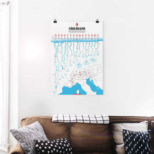
Some of Central Europe’s most important rivers have their source in the Alps. In this graphic we present the 15 longest rivers in the Alps. The Rhine is the longest Alpine river followed by the Sava, one of the many Danube tributaries in the Alps and the longest river in Slovenia. The third longest Alpine river is the Rhone, which while not the longest in France does have the largest volume of water of all French rivers.
What makes the right ski? This print sums up the decisive characteristics clearly: camber, contour, ski length, flex, radius and snow conditions. A clear infographic that makes complex ski knowledge easy to grasp – ideal for anyone who really wants to understand their equipment.
The infographic displays, arranged by color, the leader jerseys of the men's World Tour cycling races with at least 7 stages - in the 3 different classifications: general classification, sprint or points classification, and mountain classification. With the illustrated jerseys from Tour de France, Giro d'Italia, Vuelta a España - UAE Tour, Paris–Nice, Tirreno–Adriatico, Volta a Catalunya, Critérium du Dauphiné, Tour de Suisse and Tour de Pologne.
What defines a mountain? A mountain rises above its surroundings. At the same time, not every small elevation is considered a mountain. So what criteria decides what is and what isn’t a mountain? With the help of geography, a mountain can be described objectively. The most important feature of a mountain is its height above sea level. Mountaineers often strive to conquer certain thousand-metre markers. The topographic prominence measures the independence of a summit. Depending on its location, a mountain in the Alpine foothills that is only a few hundred metres high can seem more impressive than a sub peak with a height of over 4 000 metres in the Mont Blanc or Monte Rosa massif.
The Jungfrau is the highest summit of the trio it forms together with the Eiger and the Mönch. The opening of the rack railway to the Jungfraujoch at over 3400 metres in 1912 made the mountain one of the most easily accessible four-thousand-metre peaks in the Alps. The name may have passed over time from the Wengernalp on the northern slope – called Jungfrauenberg by the nuns of the former Interlaken convent – to the Jungfrau itself.
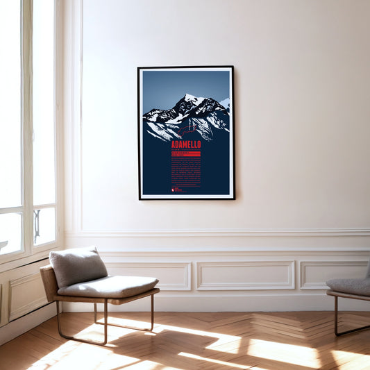
Monte Adamello is, after Presanella, the second-highest summit of the mountain group of the same name on the border between Lombardy and Trentino. The west and north faces of the Adamello rise steeply to the top, while the mountain falls away more gently towards the south-east. The Adamello lies in the Parco regionale dell’Adamello, which borders the slightly larger Parco naturale Adamello-Brenta directly to the east. Alongside ibex and chamois, larger birds of prey such as golden eagles and bearded vultures can occasionally be seen here, and brown bears only rarely.
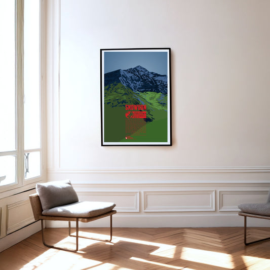
Snowdon is the highest mountain in Wales. Its Welsh name, Yr Wyddfa, means tomb, as legend has it that this is the burial place of the giant Rhitta Gawr, who was defeated by King Arthur. Snowdon is a much-visited mountain, offering fine walks across its grassy slopes. Towards the east and north, by contrast, the slopes are steep and rocky, which is why Sir Edmund Hillary trained here before the first ascent of Mount Everest.
England's highest mountain, Scafell Pike, is located in the Lake District in the north-west of the country, which was formed by glaciers and is a UNESCO World Heritage Site. It should not be confused with the slightly lower neighboring mountain Sca Fell. In 1919, Scafell Pike was donated to the National Trust by Lord Leconfield as a war memorial. Like the highest summits of Scotland and Wales, Scafell Pike is part of the “National Three Peaks Challenge”, in which all three mountains must be climbed within 24 hours.
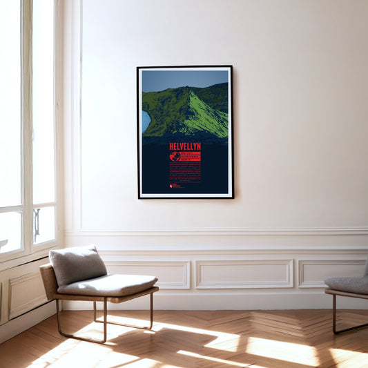
Helvellyn in the Lake District is the third highest and one of the most famous mountains in England. Its 500 meter long summit plateau is particularly striking. In 1926 even a small airplane successfully managed to land on it. On the steep and rocky east face of the Helvellyn, two ridges diverge and enclose the mountain lake Red Tarn. The southern Striding Edge is a popular route for easy climbing and scrambling. Additionally the summit can also be reached by mountain bike.
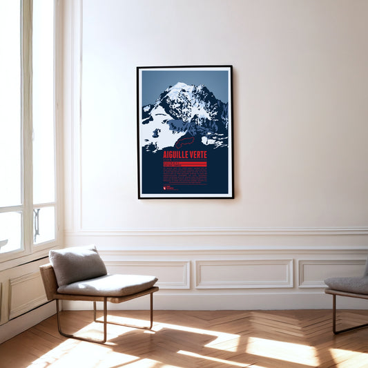
The Aiguille Verte, the “Green Needle”, is located in the Mont Blanc massif, east of Chamonix. With its rocky, pointed shape, it lives up to its name. The Aiguille Verte's massive rock face makes it one of the most challenging mountains to climb in the Alps. In some places the gradient reaches up to 55°, which is why even the normal route through the Whymper Couloir should not be underestimated. Additionally the mountain massif is surrounded by glaciers, which makes the ascent routes even more difficult.
The Monte Stivo rises north-east of Lake Garda between the two valleys of Valle dei Laghi to the west and Vallagarina to the east. The summit offers a fine view of the northern lake and of peaks including the Marmolata, the Adamello group, Presanella and the Sella group. Just about 40 metres below the top stands the Rifugio Stivo Prospero Marchetti, run by the alpine club Società degli Alpinisti Tridentini (SAT).
The Weisshorn towers north of Zermatt in the Pennine Alps. The main summit of the Weisshorn group has a distinctive pyramid shape with three sharp ridges. Although there are many other four-thousanders in the area, the Weisshorn is relatively free-standing. The rock on the mountain's three faces is quite brittle, which is why they are hardly suitable for climbing. In order to reach the summit an altitude of 3000 meters has to be transcended, requiring a high level of stamina. The route via the southwest ridge is considered to be the most difficult way to the summit.
South-east of Bad Reichenhall lies the Untersberg, the northernmost massif of the Berchtesgaden Alps. The German-Austrian border runs across its extensive summit plateau. At 1972 metres, the Berchtesgadener Hochthron is its highest peak. The whole massif is riddled with karst caves: Germany's deepest and longest known cave is found here, as is the country's only show ice cave. The famous Untersberg marble has been quarried on the northern slopes of the massif since Roman times.
South-east of Klagenfurt, close to the Slovenian border, the Obir massif rises in the Karawanks. Its highest elevation is the Hochobir. Because of the ore deposits around the Obir, mining was probably carried out here from the 12th century until the end of the 19th. In the process the Obir dripstone caves were discovered – today a protected monument – which were partly damaged by the mining work. Until 1947 the summit of the Obir was also home to one of the first weather stations in the Alps.
Mount Kailash is located in southern Tibet close to the Nepalese and Indian border, in a region that has long been considered one of the most inaccessible in the world. Its name meaning "precious snow crystal" was given due to its unique diamond shape. Especially in Buddhism and Hinduism Mount Kailash is considered to be a sacred mountain. Buddhists believe that circling around the mountain for 108 times leads to enlightenment. Due to the mountains religious significance, a climbing ban was issued. Thus Mount Kailash remains unclimbed to this day.
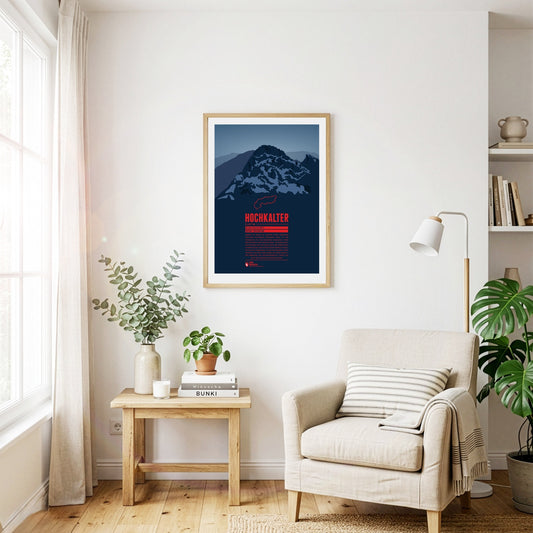
Although it often stands in the shadow of its famous eastern neighbour, the Watzmann, the Hochkalter in the massif of the same name is one of the highest summits in Germany. On its north side lies the Blaueis, the northernmost glacier in the Alps. A little further north lies the Zauberwald, a forest strewn with boulders. It was formed around 4000 years ago by an enormous rockslide on the Hochkalter massif, which also dammed up the Hintersee.
After the Mont Blanc massif, Monte Rosa is the highest massif in the Alps. Its highest summit, the Dufourspitze, is the second-highest mountain in the Alps and the highest in Switzerland. East of it, right on the border with Italy, lies the Grenzgipfel at 4618 metres, and further south the Signalkuppe (4554 m). The Capanna Regina Margherita (Margherita hut) stands directly on its summit – the highest building in Europe.
The Mont Fort is a three-thousand-metre peak in the Valais Alps rising south of Nendaz. The mountain is surrounded by three glaciers; the Glacier de Tortin to the west is part of 4 Vallées, the largest ski area in Switzerland. The Mont Fort is easily reached by cable car from Nendaz or Verbier. At the top, and in the right weather, a spectacular view opens up over the massifs of Monte Rosa and Mont Blanc.
Seinem pyramidenförmigen Gipfel hat der Machapuchare den Beinamen „Matterhorn Nepals“ zu verdanken. Der eigentliche Name bedeutet soviel wie „Fischschwanz“, an welchen der Berg von Westen betrachtet erinnert, wenn der zweite Gipfel zum Vorschein kommt. In Nepal gilt der Berg als heilig, da er der Sitz Amitabhas, dem Buddha des grenzenlosen Lichts, ist. Deshalb wurde 1964 durch den nepalesischen König ein Besteigungsverbot ausgesprochen. Bis heute gilt der Machapuchare daher als höchster unbestiegener Sechstausender.
Between the Matterhorn and Monte Rosa rises the five-kilometre-long Liskamm. Its highest point is the eastern summit. On the north-eastern side of the crest an icy rock face drops away for more than 1000 steep metres, while the heavily crevassed Lys Glacier lies to the south. The eastern summit was first climbed in 1861, and three years later mountaineers traversed the ridge for the first time. That traverse has cost many climbers their lives, which earned the Liskamm the nickname ‘the man-eater’.
West of the Sella group the peaks of the Langkofel or Sassolungo Group form a nearly perfect half circle. The two dominant summits are the Langkofel (Sassolungo) in the northeast as the highest peak of the group and Plattkofel (Sasso Piatto) in the southwest. Due to the many ski resorts in the winter the area can be accessed with various aerial lifts, among them a gondola from Sella Pass to the mountain hut Utia Toni Demetz. The famous ski circuit Sella Ronda also leads alongside the Langkofel Group.
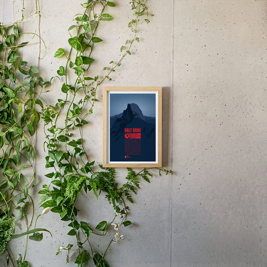
Half Dome is a prominant rock tower in Yosemite National Park. Its impressive northwest face rises almost 1500 meters (5000 feet) above Yosemite Valley. The mountain is a very popular photo motif as well as a paradise for climbers. While Half Dome was declared absolutely inaccessible for humans in 1865 only ten years later George Anderson was the first to reach the summit after successfully climbing the rock wall. In 1957 the first grade VI climb in North America was achieved at Half Dome.
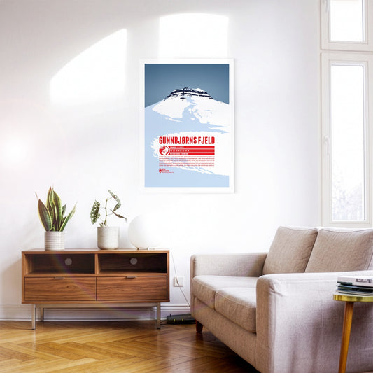
Gunnbjørn Fjeld is the highest mountain in Greenland and the highest point north of the Arctic Circle. It is named after Gunnbjørn Ulvsson, the first European to discover Greenland. Part of the Watkins Range, Gunnbjørn Fjeld rises on the island’s east coast. Because of its remote position, ascents are rarely attempted. The first documented ascent was made by a British expedition in 1935; the summit was not reached a second time until 1987.
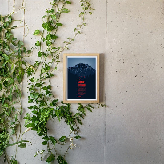
South of the German-Austrian border, the Guffert rises with its rocky twin summit. The free-standing mountain is prominently visible from the Tegernsee. With varied paths and easy climbing sections it is a popular destination for day tours. From the summit plateau a far-reaching view opens up over the Bavarian Prealps, the Wetterstein range, the Karwendel and the Hohe Tauern.
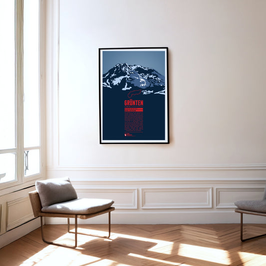
The Grünten is known as the Watcher of the Allgäu and is located south of Kempten, near the fringe of the Alps. During the Middle Ages the Grünten had already been climbed for the first time and a large deposit of iron ore was discovered. From the 15th to the 19th century many mining tunnels were dug. The iron ore production required large amounts of wood and the forest clearings on its slopes gave the Grünten ist name, since in the local dialect it simply means “bald head”.
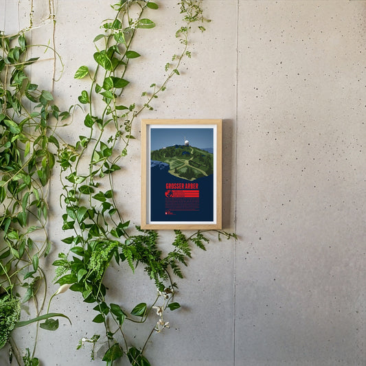
The Großer Arber or Great Arber is also known as the "King of the Bavarian Forest", since it is the high point of the mountain range. The mountain is surrounded by nature reserves and two lakes, close to the Czech border. Hiking trails and ski slopes make the Großer Arber an attractive tourist destination. On a clear day the view from the summit reaches as far as to the Alps. Next to the Aber chapel, which is just below the summit, two air force radar stations can be found, as relics of the Cold War.