The Tschingelhörner are a multi-peak mountain in the Glarus Alps. Like giant dwarves the peaks reside above a layer of Verrucano formation. This young rock formation rests on top of an older one, together forming the Glarus thrust, a famous geotope and UNESCO World Heritage Site. Even though the highest mountain of the Glarus Alps is the Tödi, the Tschingelhörner's unique shape make them a popular tourist destination as well.
Tysnesøy is situated between the Hardangerfjord and the Bjørnafjord. The north the island is mountainous. The islands’ highest point is the 753 meters high Tysnessåto.
Uluru is one of Australia's most famous landmarks, situated in the center of the country, southwest of Alice Springs. The British first named the mountain Ayers Rock. Because of its huge spiritual importance for the Anangu, the native inhabitants of the area, in 2019 climbing Uluru was permanently banned. Uluru is known for its changing colors throughout the day, especially during dusk and dawn. Another phenomenon can be observed during the rare heavy rainfalls in the area when for a short time the walls of Uluru become waterfalls.
South-east of Bad Reichenhall lies the Untersberg, the northernmost massif of the Berchtesgaden Alps. The German-Austrian border runs across its extensive summit plateau. At 1972 metres, the Berchtesgadener Hochthron is its highest peak. The whole massif is riddled with karst caves: Germany's deepest and longest known cave is found here, as is the country's only show ice cave. The famous Untersberg marble has been quarried on the northern slopes of the massif since Roman times.
Utsira is the smallest independent municipality in Norway and a popular destination. The rocky island is famous for its birdlife. over 300 species having been spotted here.
The Vanil Noir is the highest mountain of the Fribourg Alps. It lies on the border of the Swiss cantons of Fribourg and Vaud, about 20 kilometres east of Montreux and Lake Geneva. A nature reserve has existed on the Vanil Noir since 1983, notable for its many rare plants and its abundant wildlife. Among other things, 73 species of butterfly and the asp viper can be admired here, and flowers such as alpine betony and dragonhead grow on its slopes.
During the glacial melt of the last ice age the Gorges du Verdon was dug through the thick limestone in today's département Alpes-de-Haute-Provence. The breath-taking gorge is also called the “Grand Canyon of Europe”, due to the iconic steep white rock cliffs that line the course of the Verdon river and which can rise up to heigts of 700 meters over the water.
The Vesulspitze is located east of Ischgl in Tyrol and is part of the Samnaun Alps. Apart from the Piz Rots on the Swiss-Austrian border it is the highest peak of the mountain range on the Austrian side. When standing on top of the Vesulspitze one can not only admire the mighty wooden summit cross. As a relatively free-standing Three-thousander it also offers a great panorama of the surrounding mountains and valleys.
Half of the quiet and car-free island of Vlieland consists of a vast expanse of sand called the "Sahara of the North." The only village on the island is home to many historical buildings.
Wangerooge's shape is reminiscent of a seahorse. The island was hit by bombs in the Second World War. Today things are peaceful, with the island railway trundling gently through the landscape.
What defines a mountain? A mountain rises above its surroundings. At the same time, not every small elevation is considered a mountain. So what criteria decides what is and what isn’t a mountain? With the help of geography, a mountain can be described objectively. The most important feature of a mountain is its height above sea level. Mountaineers often strive to conquer certain thousand-metre markers. The topographic prominence measures the independence of a summit. Depending on its location, a mountain in the Alpine foothills that is only a few hundred metres high can seem more impressive than a sub peak with a height of over 4 000 metres in the Mont Blanc or Monte Rosa massif.
What makes the right ski? This print sums up the decisive characteristics clearly: camber, contour, ski length, flex, radius and snow conditions. A clear infographic that makes complex ski knowledge easy to grasp – ideal for anyone who really wants to understand their equipment.
The Watkins Range is the highest mountain range on Greenland, including the island's highest mountain Gunnbjørn Fjeld. Other notable three-thousanders of the range include Gunnbjørn Dome (3682 m) and Gunnbjørn Cone (3669 m). The mountains in the Watkins Range are so-called “nunataks”, rocks which emerge from an area which is otherwise covered entirely by ice and glaciers.
Legend tells that the Watzmann is a royal family, turned into stone after being cursed by a woman. As the central massif of the Berchtesgaden Alps it shapes the entire landscape of southeastern Upper Bavaria. The east face is one of the most fascinating challenges for climbers in the entire Alps.
The Weißkugel is the third-highest mountain in Austria. Its position directly on the main Alpine crest also makes it the highest summit on the Austrian-Italian border. Four summit ridges meet on the Weißkugel, with glaciers between them. One of them, the Hintereisferner, has been studied scientifically for more than 100 years – one of the longest continuous time series in glacier research.
The Weißseespitze is a mountain in the Weißkamm of the Ötztal Alps on the border between Tyrol and South Tyrol. It lies east of Lake Reschen at the end of the Langtaufers valley (Italian: Vallelunga). The border between Austria and Italy runs across the summit. In Italian the mountain is known as ‘Cima del Lago Bianco’ – a literal translation of the German name.
The Weisshorn towers north of Zermatt in the Pennine Alps. The main summit of the Weisshorn group has a distinctive pyramid shape with three sharp ridges. Although there are many other four-thousanders in the area, the Weisshorn is relatively free-standing. The rock on the mountain's three faces is quite brittle, which is why they are hardly suitable for climbing. In order to reach the summit an altitude of 3000 meters has to be transcended, requiring a high level of stamina. The route via the southwest ridge is considered to be the most difficult way to the summit.
The snow-covered summit of the Weissmies looks as if it were covered in white moss. The mountain owes its name to this: in the local dialect, ‘Mies’ means ‘moss’. Situated in the Valais Alps, the Weissmies is the highest summit of the Weissmies group and gives it its name. It was first climbed in 1855 and is considered one of the easier four-thousand-metre peaks to ascend. From the summit the view sweeps across the neighbouring peaks of the group and the Mischabel range to Monte Rosa, and down into the Saas valley to Saas-Fee in the west and the Simplon valley in the east.
The infographic displays, arranged by color, the leader jerseys of the men's World Tour cycling races with at least 7 stages - in the 3 different classifications: general classification, sprint or points classification, and mountain classification. With the illustrated jerseys from Tour de France, Giro d'Italia, Vuelta a España - UAE Tour, Paris–Nice, Tirreno–Adriatico, Volta a Catalunya, Critérium du Dauphiné, Tour de Suisse and Tour de Pologne.
Wheeler Peak is the highest mountain in New Mexico, situated in the Sangre de Cristo Mountains, the southernmost Rocky Mountains subrange. First known as Taos Peak, the mountain was renamed in 1950, after George Montague Wheeler, a cartographer and explorer. Only 15 miles southwest skiers can enjoy the slopes of Taos Ski Valley.
Wheeler Peak is Nevada's second highest summit, being only 82 ft (ca. 25 m) lower than Boundary Peak, but more prominent than the latter. It is also the highest mountain of the Snake Range. As the mountain with the same name in New Mexico, it is named after George Montague Wheeler, who explored the area in the 19th century. The mountain is part of the Great Basin National Park, which was established in 1986.
Despite its comparatively modest height, the Wilder Kaiser is one of the landmarks of the Eastern Alps thanks to its prominence and easy accessibility. The Kaiser range is a popular destination for climbers and skiers alike. Pioneers such as Hans Dülfer developed entirely new climbing techniques here, and the "Wilder Kaiser/Brixental" ski area, one of the largest in Austria, extends across its slopes.
The Wildspitze is the second-highest mountain in Austria and the highest of the Ötztal Alps. Thanks to its great prominence, the view from the Wildspitze is limited in practice only by the curvature of the earth, reaching from the Bernese Alps in the west, with the Bietschhorn and the Aletschhorn, to the Schober group in the east. In the last century the north summit was the higher of the Wildspitze’s two peaks, but it has melted away; today the south summit is the highest point of the mountain.
Mount Yari is centrally located on the Japanese island of Honshū in Nagano Prefecture. It is situated in the Hida Mountains, which are part of the Japanese Alps. Mount Yari is one of the “100 Famous Japanese Mountains”, which were listed by Kyūya Fukada in 1964, and it is the fifth highest peak of the country. The mountain owes its name Yari, which translates to “spear”, to its characteristic pointed shape. For this reason it is also known as the “Matterhorn of Japan”.
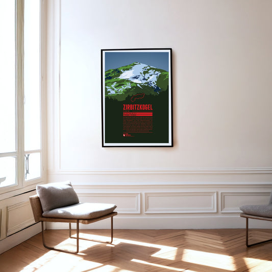
The Zirbitzkogel is the highest mountain of the Seetal Alps and very well developed for visitors, with plenty of huts and accommodation. Walking paths lead up from every direction, passing several small lakes and shortening the ascents considerably. The Zirbitzkogel is also known for its rich fauna and flora: Swiss stone pines grow on its slopes, and at higher altitudes spignel and alpenroses thrive. Very rare species of butterfly and breeding grounds of the Eurasian dotterel are found around the mountain too.
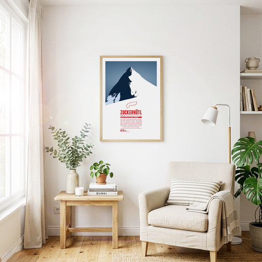
The Zuckerhütl on the border with South Tyrol is one of the most characteristic mountains in the Alps. Its northern side is covered by the mighty Sulzenauferner glacier, while to the south it drops away steeply for hundreds of metres. In good weather you can see as far as the Ortler from its summit, and enjoy the pistes of the Stubai valley on its slopes.
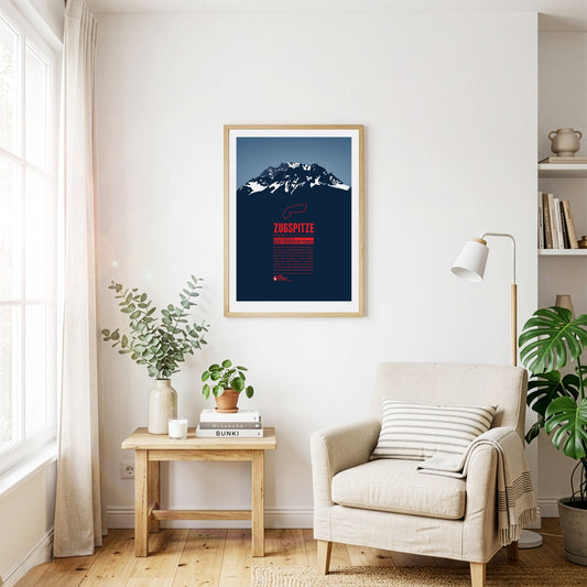
The Zugspitze is Germany's highest mountain and the highest peak of the Wetterstein Mountains. Below the summit there is a ski area and three glaciers which will probably disappear in the years to come in course of the climate change. An asteroid has been named after the Zugspitze. On the summit which can be reached with three different aerial lifts there is even a little theme park.
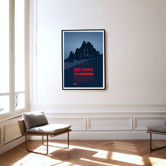
The Zwölferkofel or Zwölfer (Twelver) is one of five mountains which together form the Sexten Sundial. Seen from Moos near the town of Sexten, at noon (solar time) the sun is roughly over the Zwölferkofel's summit. Accordingly the neighbouring summits are named with numbers from nine to one (in German: Neuner, Zehner, Elfer, and Einser). As many Dolomite peaks, for climbers the Zwölferkofel is a popular and challenging destination.
Regular price
from 19 €
Regular priceSale price
from 19 €
Books, maps and more.
About the Alps and the world.