 Ski Blue
 Mountain Green
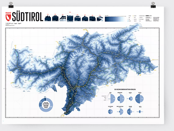
 Map Grey
Release date: 01-12-2018
Size: 840 x 594 mm
Print: Digital print 200 g matt
Language: German
Styles - 3 unique designs
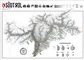
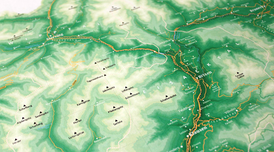
Our map shows the most important cities, streets, rivers and waters, the most important mountains, as well as the borders of eight districts of south Tyrol. South Tirol is available in three unique designs:blue from our maps of the ski resorts, green style from our mountain maps or the grey of “Mapping Out the Alps”.
Style – Ski Blue
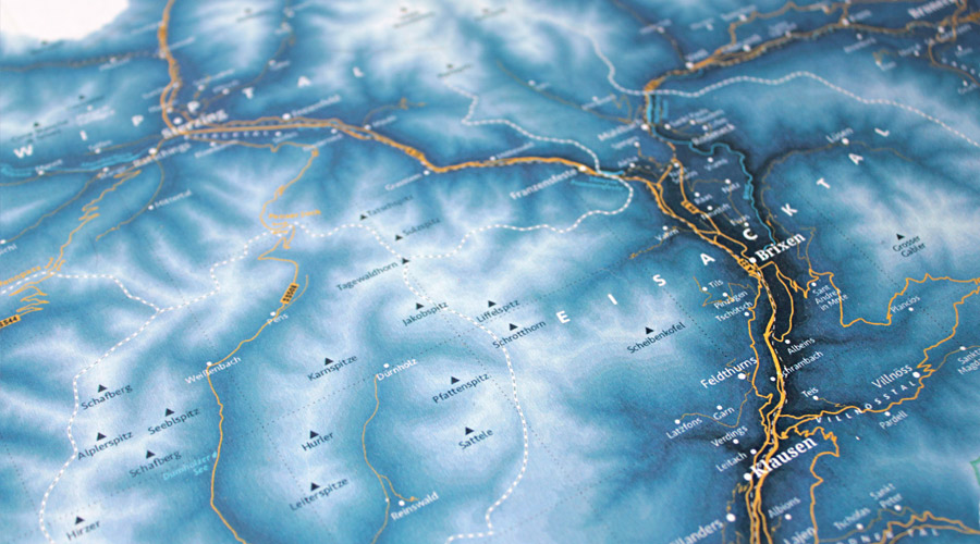
This well-known and popular style is used on our maps of the ski resorts. Shades of blue show the different altitude levels. From deep blue in the valleys to the Alpine white up on the mountains above 3,000 meters.
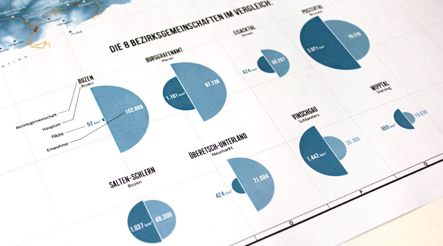
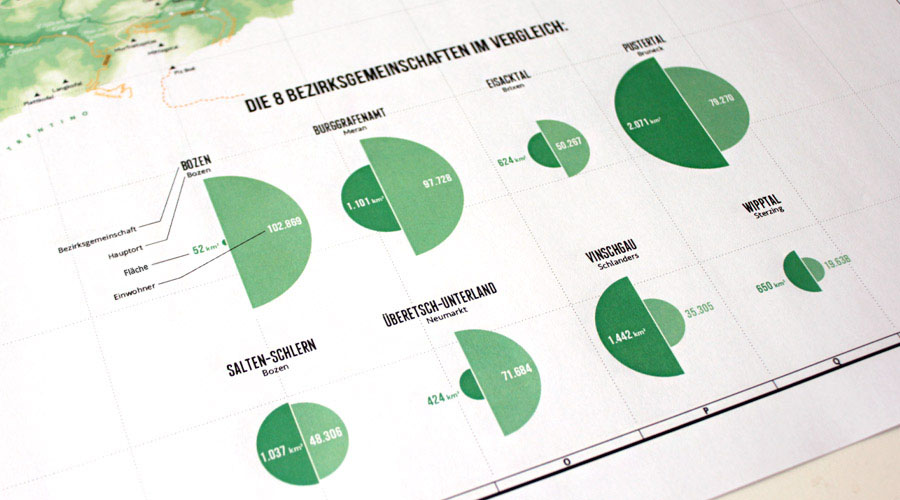
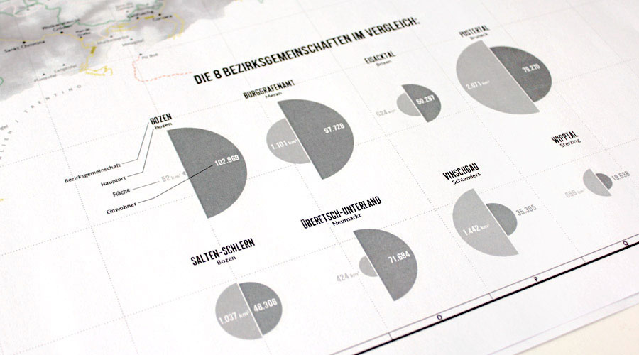
Our infographic compares the eight districts of South Tyrol in terms of population and area.
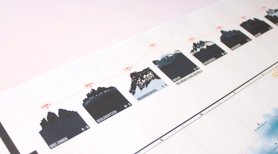
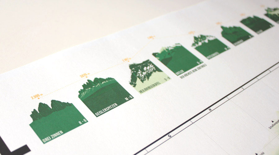
The map also shows a selection of South Tyrol's most impressive mountains, most of which are also available as illustrated A3-prints:
Drei Zinnen (Tre Cime di Lavaredo),
Geisler Group,
Heiligkreuzkofel,
Ortler,
Peitlerkofel,
Sassongher,
Schlern,
Seceda.
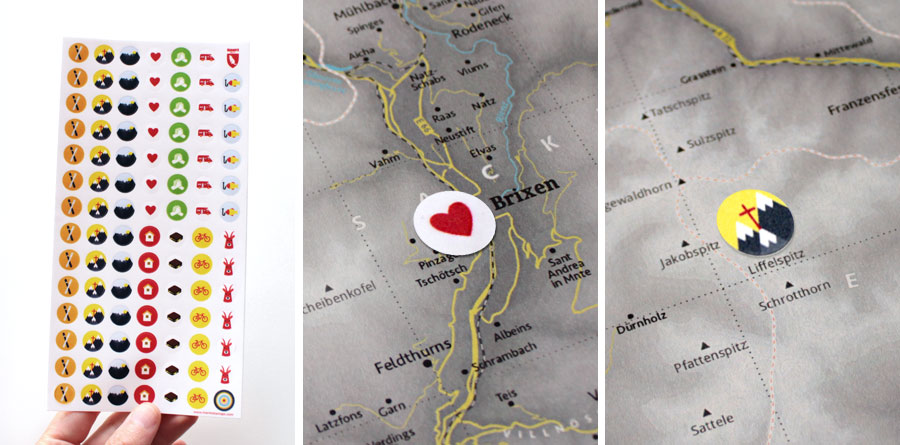
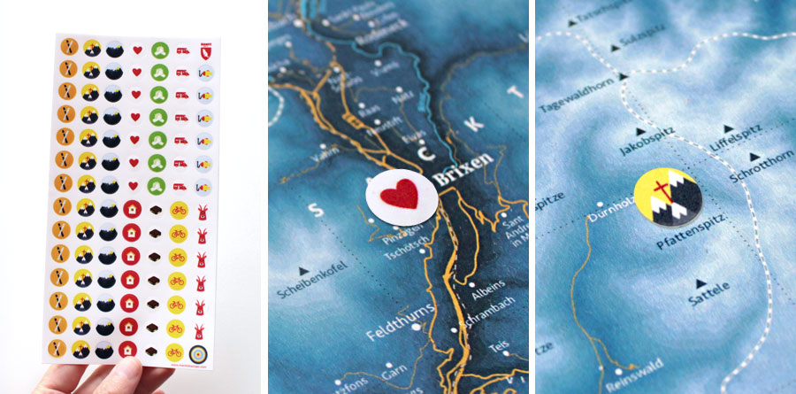
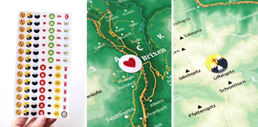
Marmota Stickers
for the South Tyrol Map
Our matching Marmota sticker set lets you mark your own special experiences.
Style – Mountain Green
We use this style for our mountain and hiking maps. The altitude profile consists of different shades of green.

Our infographic compares the eight districts of South Tyrol in terms of population and area.
The map also shows a selection of South Tyrol's most impressive mountains, most of which are also available as illustrated A3-prints:
Drei Zinnen (Tre Cime di Lavaredo),
Geisler Group,
Heiligkreuzkofel,
Ortler,
Peitlerkofel,
Sassongher,
Schlern,
Seceda.
Marmota Stickers
for the South Tyrol Map
Our matching Marmota sticker set lets you mark your own special experiences.
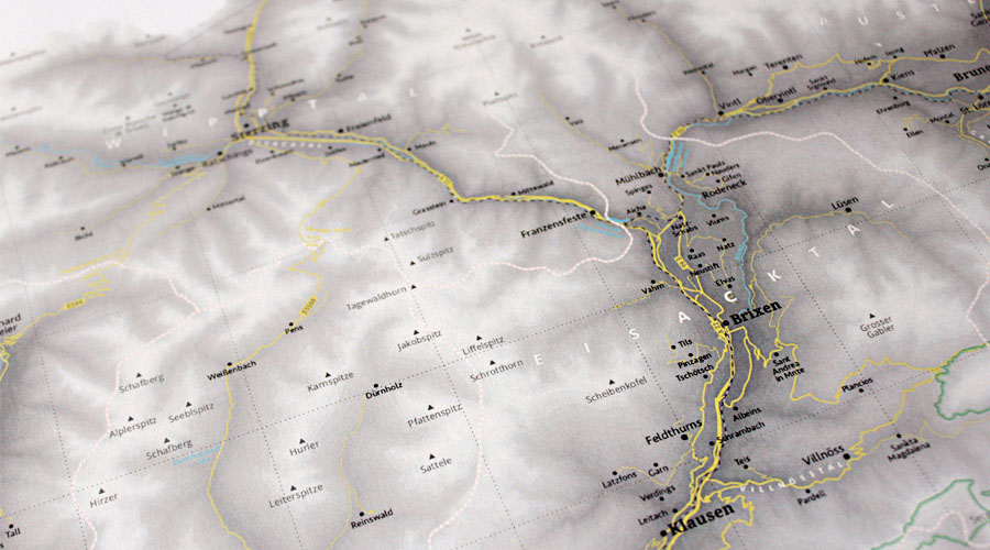
Style – Map Grey
This style is based on our map “Mapping Out the Alps”. The altitude profile consists of different shades of grey, which allows for own markings to be easily visible.

Our infographic compares the eight districts of South Tyrol in terms of population and area.
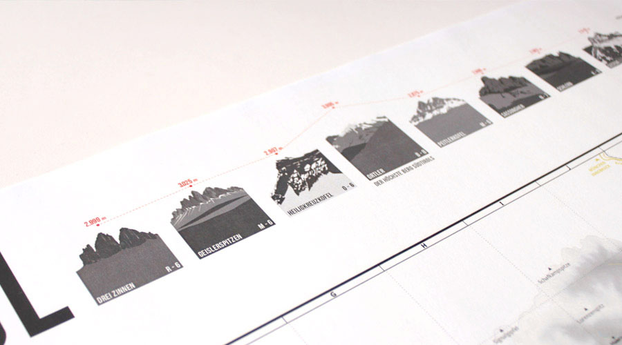
The map also shows a selection of South Tyrol's most impressive mountains, most of which are also available as illustrated A3-prints:
Drei Zinnen (Tre Cime di Lavaredo),
Geisler Group,
Heiligkreuzkofel,
Ortler,
Peitlerkofel,
Sassongher,
Schlern,
Seceda.
Marmota Stickers
for the South Tyrol Map
Our matching Marmota sticker set lets you mark your own special experiences.